Author: Happy Mountain

  • Nar Phu Valley Trek: A Hidden Himalayan Gem in Nepal

    Nar Phu Valley Trek: A Hidden Himalayan Gem in Nepal

    Nar Phu Valley Trek: A Hidden Himalayan Gem in Nepal

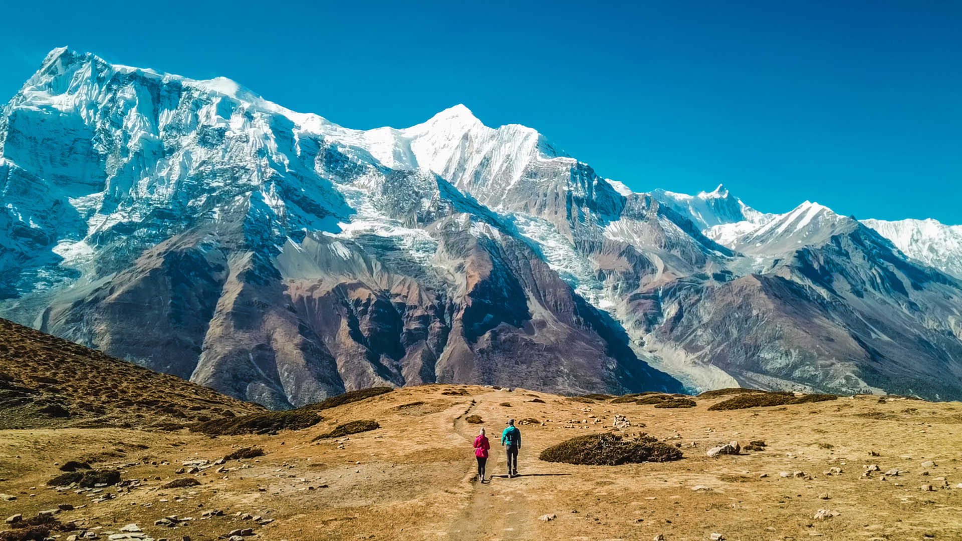
    Nar Phu Valley is an untouched and inaccessible part of Nepal’s Annapurna, bordering on Tibet. It had no visits by trekkers until 2002, but it presents a virgin Himalaya scene, ultra-rich Tibetan heritage, and medieval villages that remain suspended in animation. Nar Phu Valley was named after the two largest villages, Nar and Phu, which have a strong Buddhist history in the shape of stunning old monasteries, prayer walls, and chortens amidst a stunning high alpine landscape. The trek to Nar Phu Valley is an off-the-beaten-path trek far from the more touristy trails. It zigzags and turns up through steep canyons, mountain forest, and high passes like the strenuous Kang La Pass (5,320 m).

    Nar Village & beautiful mountain in the background
    Nar Village

    Why Nar Phu Valley Trek special?

    Nar Phu Valley Trek is a combination of high-altitude trekking and cultural trekking. It was forbidden for foreign trekkers until 200,3 and therefore it was virgin and daily culture. The main reasons that this trek must be included as a must-do trek are as follows:

    1. Tibetan Culture

    Residents of Phu and Nar live in a culturally isolated area, and the old Tara Nagar Tibetan culture has been preserved there for some time now. The villagers were isolated from the world for centuries, and while it might not be possible to be exclusive again after 2002, culture can be exempted from the brutalities of mass tourism. The villagers in Phu and Nar are ethnic Tibetans, and their existence is based on agriculture, cattle, and Buddhism. You can witness remnants of Tibetan ways of life in the villages through which you pass in the hills – remnants from earlier centuries of Tibetans living ways of life that reflect their religion, culture, daily way of living, and even communities through architecture. You might see a few of the same things.

    Gho Chorten near Nar Village on the way to nar from nar phedi
    Gho Chorten

    Tattered prayer flags on a prayer pole waving in the breeze; Buddhist prayers inscribed on mani walls painted along trails; the villagers wearing their traditional clothing, following a cultural ritual.
    Prayer and monks and nuns living here in monasteries; yak and yak herding; grinding tsampa or butter tea are something you would notice, but not something you would experience or witness anywhere else.

    This action is not performed for the purpose of showing it to visitors—it is real and lived. The culturally aware tourist will have open to him a landscape which is a window on the historic and religious dimensions of life in the Tibetan Himalaya.

    2. Nar and Phu Villages

    Phu Village is a picturesque village in the area, being a walled medieval village.It is placed higher up above the valley on a shelf and built into the side of our cliff which consists of stone.

    Phu, with fewer than 300 residents, has a quality of timelessness. It has stone and mud houses, thin pathways, rice terracing paddies, and ancient chortens. Phu has many monasteries, among which the sacred Tashi Lhakhang Gompa is said to have been consecrated by Guru Rinpoche. It gives you a realistic impression of an uncluttered, simple Himalayan highlander way of life, it gives you a real quality.

    Nar Village lies in a larger, more open valley. It is easier to access, it is sunny, warmer, and open compared to Phu. The people of Nar built their houses keeping hospitality in mind; they are actually famous for being hospitable. There are monasteries and gompas there too, but at Nar, because it is an open plot of land, the weather isn’t the same, there’s more sunlight, and distant views over some mountains.

    Nar and Phu together show us two aspects of Himalayan existence—ecclesiastic and sequestered on one hand, and agrarian and open on the other.

    Nar Villages & mountain view
    Nar Village

    3. Kang La Pass (5,320m)

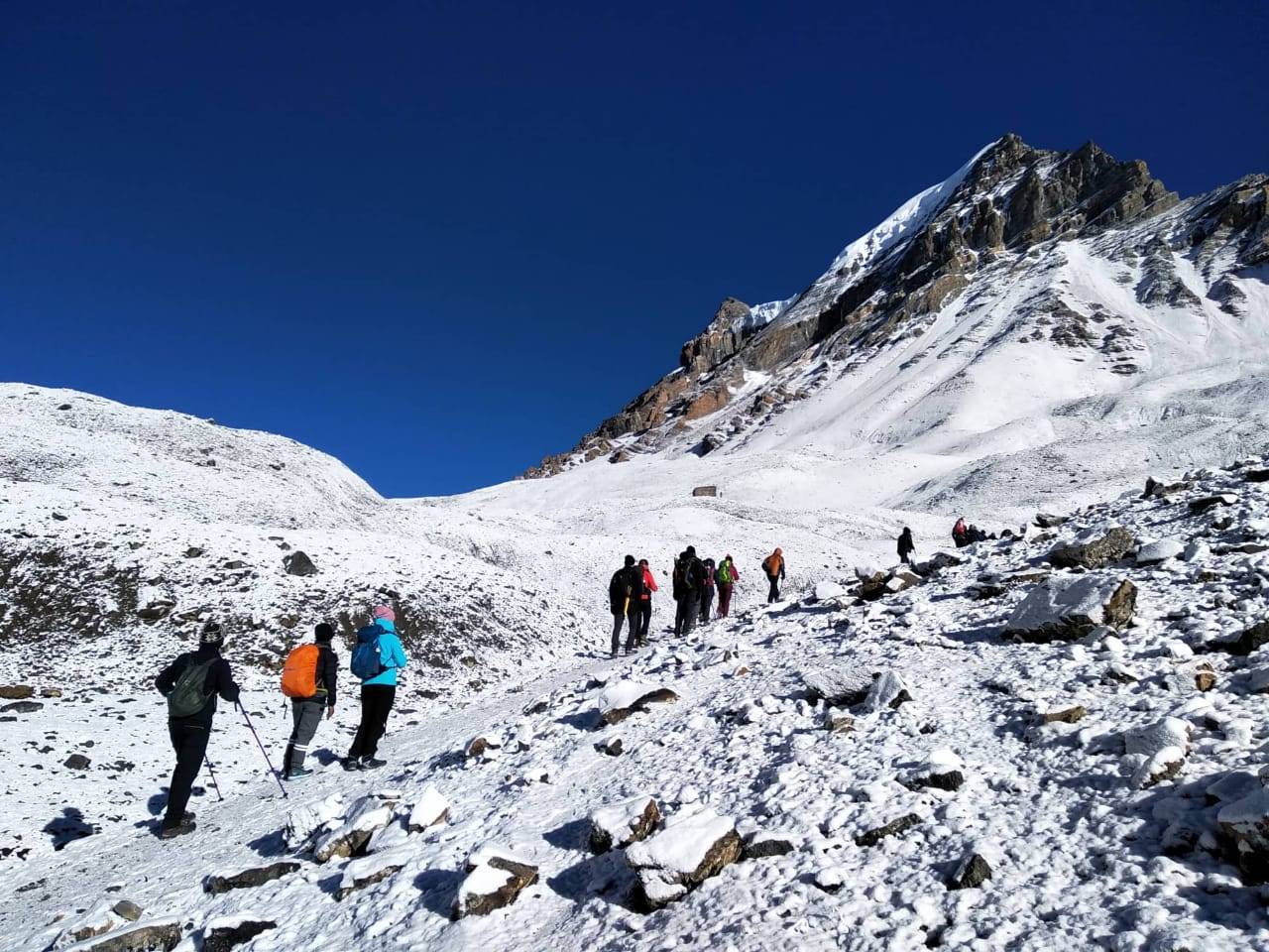
    Icing on the trek—the Kang La Pass—literally and metaphorically. Physical and technical challenges to ascend to the height of the 5,320m pass. The pass links the isolated Nar Valley to the Annapurna circuit, and voila, stunning views of some of Nepal’s most mythically sparkling mountains. Over Annapurna II, it glows yellow or dissolves into whirlpool vapors along with Tilicho Peak, Gangapurna, and thousands of other high domes depending on the hour.

    Always an early-morning trip to the Kang La, and one to arrive in town with snowshoes on backs to packs we’d cached between greasy and bare streets. It was worth it, for a flavor involuntarily, the creative ritual of another kind, conquest, and solitude. Tours to Kang La as initiation for the tour—and it Gondá, far from trekking, off the maps Nar Phu valley totaled more touristed areas of Manang, and the Annapurna. Time to travel light and be humble.

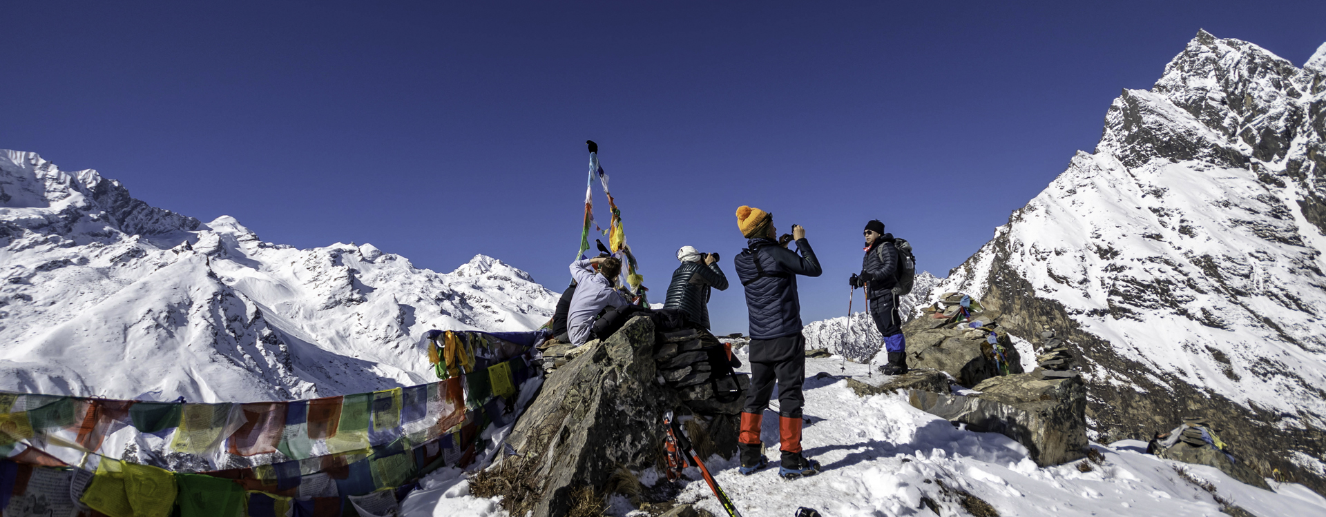
     Kang La Pass (5,320m) sign & surrounding mountains
    Kang-La pass 5320m

    4. Himlung Himal Base Camp

    For those with a little more than one day or even two to spare to allow them to finish their itineraries and those who would want some raw adventure in between, then the Himlung Himal Base Camp trek would be well worth the trouble. At about. 4,900 meters below, beneath the 7,126-meter summit top of Himlung Himal, one of the less-climbed and less-used summit tops of the Peri Himal massif, lies the base camp. You are embarking on your trekking experience from Phu, and your trek passes through rising and rising glacial and rocky terrain.

    It is a modest trail and will find you utterly alone. You will be walking on alpine meadows, moraines, and snow creeks with hardly, or nobody around. You get a sense of scale. The ginormous mountains, glaciated ridges, and serenity of high country vistas will give you an experience that’s intimate and unspoiled. It is the photographer’s dreamland, nature lovers’ heaven, or a choice for those who are prepared to earn their respect with their endurance at heights.

    Himlung Himal Base Camp tents & snow fall
    Himlung Base Camp

    5. Monasteries of Nar Phu Valley

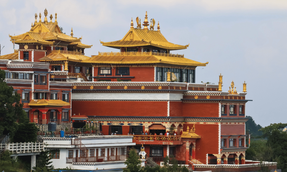
    The throbbing heart of spirituality of the Nar Phu Valley is the monasteries. The extremely ancient buildings, temples of faith and repositories of centuries of spirituality, art and religious self-control. Among them most ancient and sacred is the Tashi Lhakhang Gompa near Phu. A peaceful, contemplative shrine where candles somehow burn low across statues, butter lamps aglow and the eternal hum of chant resonating out.

    You catch a glimpse of the Tibetan Buddhist lifestyle and how it extends to everyday life upon visiting them. They are visited by the monks, usually from nearby villages, who are practicing such on special Buddhist holidays. Trekkers may be asked to join in the rituals or sit and observe. The peace and quiet of such monasteries offer the best antidote to the violence of the trek along the trail and to rest and relearn the spiritual interiority of the adventure.

    Beautiful Monastery at Nar Phedi
    Nar Phedi Monastery

    6. Varied Landscapes of Nar Phu Valley

    The crown jewel of the trek is the stunning diversity of landscapes that you get to witness. Off you go on forest paths, along stony thunder brooks; then it runs along dusty alpine with walls of bare rock, giant valleys and scree hiking and to finally top up the snowfields and glacial ridges under big open wide skies.

    As this topography shift goes on, the phases and elements remain fascinating. You may be trekking through pine woods with rhododendron in parts and wind-lashed desert plateaux with scrub so low-growing, it’s nearly short-grass in places. To witness these green and brown, wet and dry, white and treeless all together is to exercise the rhythm of the physical and mental aspects of the trek—a gradient of challenge, wonder and understanding.

    Manang Village from hundred lama cave


    7. Hidden Gems: The Remoteness of Nar Phu Valley

    Nar Phu Valley is one of the last of Nepal’s virgin and off-the-beaten-path trekking areas. Because it was the last to have been closed and reopened to trekkers, the valley has remained free from its cultural and environmental truth being eroded. You will not find large tea houses, Wi-Fi, and souvenir shops. You will find a place where humans are fewer than yaks and stars still twinkle unfazed by man-made light.

    This solitude demands solitude from you, and the payoff is enormous. It’s a journey through silence, solitude, and self-discovery. There’s a sense of discovery with every twist on the trail. There are secret waterfalls, unexpected wildlife sightings (blue sheep and Himalayan griffons, to mention a few), and isolated villages outside of time. For the travelers who want something new from Nepal’s more popular and beaten-up treks, this trek offers something unexplored and transformative.

    Nar Phu Valley Trekking Itinerary (15 Days)

    traditional village at Phu village
    Phu Village

    Here’s a standard 15-day itinerary that ensures proper acclimatization and a complete experience of the region.

    Day 1: Arrive Kathmandu (1,400m)

    You will reach Tribhuvan International Airport, Kathmandu, and there you will be met by your representative who will welcome you and drop you to your hotel. You check in the hotel or you stroll along the pleasant backroad of Thamel which is the trekker’s paradise. Subject to time, Swayambhunath (Monkey Temple) or Kathmandu Durbar Square is not far on walking distance from there. Orientation in the evening – trekking routine.

    Day 2: Besisahar to Koto (2,600m) – 8-9 hour mountain road drive

    The day begins on the long drive tours with the beginnings on a bananaskin and picturesque road and concluding on off road drive. Where one rests is Besisahar which marks the beginning of your Annapurna Circuit trek. The jeep ride has bumps to it as it’s another scenery ride on villaged and hills; and there’s the bumpy but scenery ride on Marsyangdi River gorge. We ride from Besisahar to Koto through pine forest lined with village and cliff-covered, the start of the Nar Phu Valley trek.

    Day 3: Koto to Meta (3,560m) – 7 hours

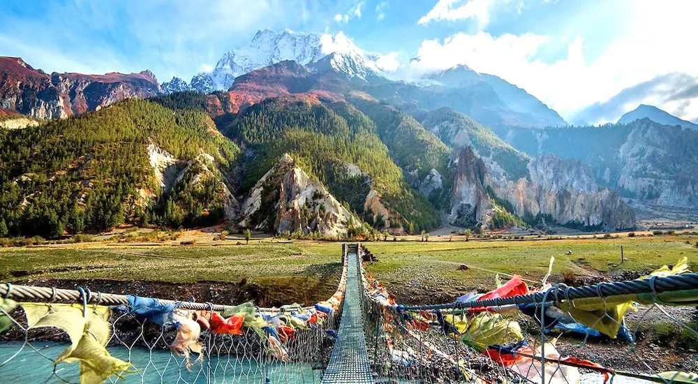
    You will have to cross permit barriers at the police check point on entry to the Nar Phu closed valley. You will walk through dense pine and rhododendron forests, suspension bridges, river-carved boulder fields in the Naar Khola basin, and steep rock faces. The trek is easy and without steep slopes and boulders. You will reach Meta, a hidden Tibetan village, and see sweeping views and ancient chortens.

    Day 4: Meta to Phu Gaon (4,080m) – 7 hours

    Here you get to see beautiful canyon walls, and the canyon wall on either side has been engulfed, and in between are scattered Tibetan villages. You trek through Kyang and Junam – last season grazing grounds, and climb slowly towards Phu village. As you reach the Phu village, you will be able to observe the chortens and mani walls rising high above the mystic rim of the valley like the valley’s ancient sentinels. Phu Gaon is located on a ridge with great views and an always-dominant atmosphere.

    Day 5: Acclimatization Day at Phu Gaon

    Rest and acclimatization day at high altitude. Day excursion a Tashi Lhakhang Monastery blessed by Guru Rinpoche. Half-day trek to a view hill for bird’s-eye view of the village, yaks and cliffs surrounding the village. Visit to the villagers will provide insight into their hard Tibetan life – spiritual and conservative.

    Day 6: Phu to Nar Phedi (3,490m) – 5 hours

    The return route is half way down the valley. Over suspension bridges you walk and step on to single chortens to arrive at Nar Phedi where yet another experience you’ll be discussing for years to come—you’re sleeping in a modest nunnery monastery. It’s a good place to go slack, little luxuries but warm warm heart.

    Day 7: Nar Phedi to Nar Village (4,110m) – 3 hours

    A serene, short trek to that beautiful Nar village. A lot of prayer flags and colored rocks along the way to observe and distinguish is not impossible. Phu less in population but Nar larger in size and population of the rock villages and fields and monasteries’ center. More people and crops here.

    Day 8: Exploring Nar and Acclimatizing.

    Spend the day experiencing the local lifestyle. You may check out some local gompas, have traditional yak butter tea, and check out the nearby viewpoints for amazing views of some of the Himalaya. This extra day is also important because it gives your body some time to adjust to the altitude before we cross the Kang La Pass, you can also hike to the high yak pastures for a relaxing nature walk.

    Day 9: Cross the Kang La Pass (5,320m) and Trek to Ngawal (3,660m) – 8-9 Hours.

    The longest and most challenging day begins with an early start before dawn. You will gradually ascend on rocky trails toward the snow-covered Kang La Pass. After getting to the top, you will be rewarded with magnificent views of Annapurna II, the Tilicho Peak, and Gangapurna. After crossing the pass, you will descend down to Ngawal, where you will make a steep descent down scree and meadows. Ngawal is a traditional village with guesthouses, warmer conditions, and a chance for a slightly more relaxing day.

    Day 10: From Ngawal to Manang (3,540m) – 4 hours

    You’ll descend lightly along the Marsyangdi River, enjoying views of the Annapurna range and forested hills, passing ancient caves and monasteries. Manang is a lively town with a lot of trekkers, featuring bakeries, cafes, and a Himalayan Rescue Association clinic offering a professional service. It is a good place to charge your batteries.

    Day 11: From Manang to Yak Kharka (4,050m) – 4 hours

    You will leave behind the forested areas and the trail will take you into some alpine landscape where you may encounter grazing yaks and larger herds of blue sheep. The walk is mostly gradual with the exception of a couple of steep areas. Yak Kharka, your stop for the night, is a small, windswept outpost set against a backdrop of incredible mountain scenery. Yak Kharka is the perfect stop for a night as you acclimatize before heading toward the final pass.

    Day 12: From Yak Kharka to Thorong Phedi (4,450m) – 3-4 hours

    This is a short but essential day for rest before your longest ascent. You will need to cross small wooden bridges and sections of landslide, reaching your last overnight stop before the Thorong La. Thorong Phedi (the base camp) has the basic comforts you need and you will need an early sleep in anticipation of your climb tomorrow.

    Day 13:Trek to to Muktinath via High pass (Thorang La xa)

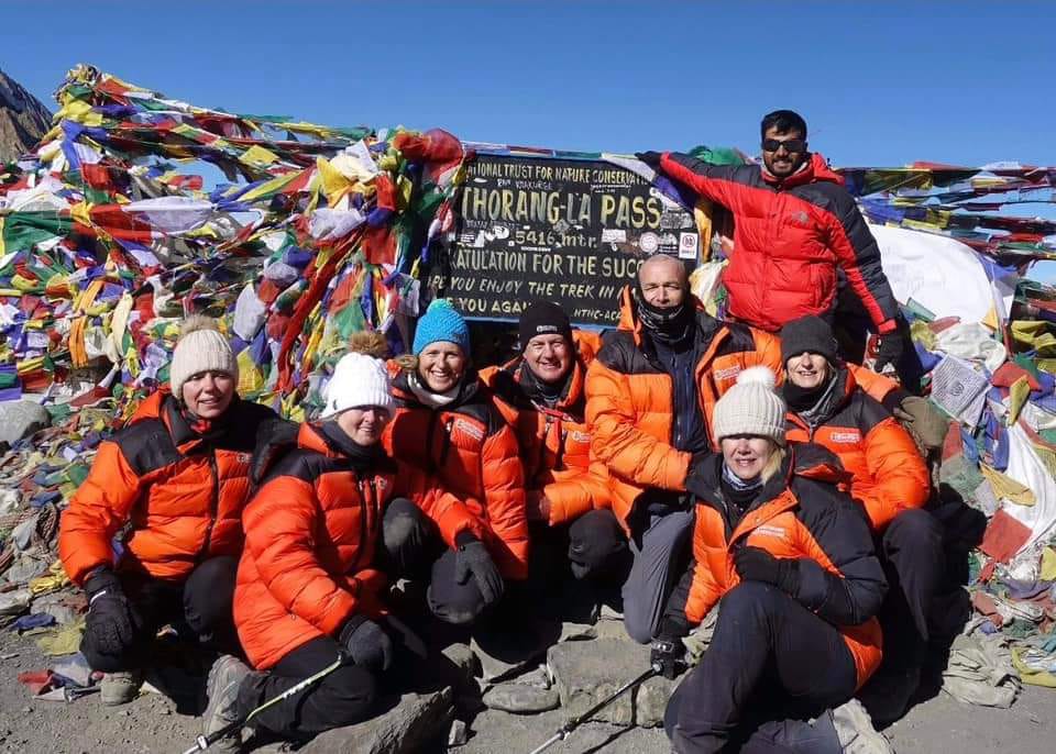
    This is the hardest, but the moment you’ve all been waiting for. The trek starts very early, generally at 4:00 AM, so that you can reach the summit of the trek as soon as possible, before the weather has time to snap and before the winds that have kept you warm through your first couple of weeks of trekking kick up again. The route is a steep ascent from your last high camp or lodge, and begins to traverse the final ridge or hill, but it will consistently climb in height as you walk to the Thorong La Pass at 5416 (17769 ft) meters.

    Day 14: Drive to Muktinath to Maroha via kagbeni

    After a night of sleeping in Muktinath, we will drive to Marpha, through a lovely village in the Lower Mustang region, without proceeding likewise in Kagbeni (the village is open to some wind – it is the intersection of the Jhong and Kali Gandaki Rivers).

    Day 15: Drive to Pokhara

    You will be in Pokhara at your lake-front hotel well ahead of the time when you can unwind and watch the tranquil beauty of Phewa Lake, cafes, or indulge in an optional massage after some hard days of trekking. All good things must end!


    Permits and Requirements for Nar Phu Valley

    As Nar Phu is a restricted area, the following permits are required:

    Trekker has to pass through a registered agency and in a group of two or more individuals with a licensed guide.

    Best time to trek the Nar Phu Valley

    The best months to trek in the Nar Phu Valley are:

    Spring in the Nar Phu Valley: March to May when wildflowers begin to bloom and the sky is usually clear.

    Autumn in the Nar Phu Valley: September to November, when stable weather conditions enhance mountain visibility.

    Avoid monsoon (June – August) and severe winter (December – February) months since you would either be trekking in rains or crossing passes that had just been closed for winters.

    What to Bring on the Nar Phu Trek

    You will need:

    • Warm clothes in layers (base, mid, and outer layer)
    • Good quality Wellington hiking shoes/boots
    • Sleeping bag (-10degreese Celsius bag would be suitable)
    • Sunglasses, sun block, and lip balm
    • Reusable water bottle and water purification tablets
    • First-aid kit with altitude medication
    • Headlamp and spare batteries
    • Snacks and energy bars


    Conclusion

    The Nar Phu Valley Trek is an experience unlike any other and will open your eyes to unspoiled beauty, isolation, and cultural wealth. Whatever and whoever you are, seasoned trekker or another tourist seeking something real and worthwhile, the trek will render one of the real highlights of Nepal and the Himalayas. With a bit of planning and a dash of good luck, you’ll take away memories and experiences that will last a lifetime, and a sense of Nepal’s untouched spirit. Contact us today at Happy Mountain Nepal, on Facebook, Instagram, or TikTok

    FAQs

    1. Do I need a special permit for the Nar Phu Valley Trek?

    Nar Phu Valley is a restricted area of Nepal. Restricted Area Permit (RAP), and Annapurna Conservation Area Permit (ACAP) is needed. They can be purchased through a registered trekking agency, and the group should be at least two trekkers.

    2. How challenging is the Nar Phu Valley Trek?

    The trek is challenging to strenuous. There are long days of trekking, remote landscape, and high altitude (highest point 5,320m at Kang La Pass). It is strongly advised to have good physical fitness and prior trekking experience.

    3. What is the best season to undertake the Nar Phu Valley Trek?

    The best season is spring (Mar.-May) and autumn (Sept-Nov). Blue sky and clear weather, pleasant climatic conditions, and breathtaking mountain views. Extremely cold in winter, and the pass gets closed due to snowfall; monsoon is non-stop rain and wet trails.

    4. How long does the trek take?

    The normal time is 15 days, including acclimatization and side trips such as Himlung Himal Base Camp. It may be extended if done as a part of the Annapurna Circuit.

    5. Is there teahousing or must I camp?

    There are village teahouses and lodges in each village: Koto, Meta, Phu, Nar, and Ngawal. Simple, lodging is still available, and particularly at Phu and Nar. Camping equipment is not necessary, bbut it ill be useful if lodges are shut down or full.

    6. Is there a mobile network or Wi-Fi on the trail?

    Cell phone reception is poor and patchy in most of the valley. No Wi-Fi and few spots like Manang, or Koto. Expect to do a digital detox and carry a satellite phone if you need it.

    7. What wildlife can I expect to see?

    Blue sheep, Himalayan griffons, lammergeiers, and snow leopards (sometimes) inhabit the cold climate. Alpine flora and common birds inhabit the high-altitude region. Domesticated animals and yaks inhabit the spot very often.

    8. How cold is it?

    Night temperatures lower than -10°C are found at high altitude, for instance, at Phu, Nar, or Kang La Pass. Weather is usually sunny and good, however. Weather gets really awful without warning. Fleece and warmer clothes are a must.

    9. Is the Nar Phu Valley Trek for starters?

    This is not a beginner’s trek because it is inapproachable, at high elevation, and physically demanding. The trekkers must be seasoned to some degree at high elevation and must have some elementary understanding of survival skills in the mountains.

    10. Is altitude sickness a concern?

    Yes. It’s more than a 5,000-meter walk, so altitude sickness is a definite possibility. The days have been scheduled to reduce as much of that as possible by adding acclimatization days but be sure to monitor also for symptoms. Trip insurance with evacuation is strongly recommended.

  • Rara Lake: Known for its serene beauty and trekking opportunities

    Rara Lake: Known for its serene beauty and trekking opportunities

    Rara Lake: Known for Its Serene Beauty and Trekking Opportunities

    Situated in the remote northwest wilderness of Nepal, Rara Lake is a heaven yet to be explored by visitors in its raw natural beauty, peaceful surroundings, and welcoming trekking trails. It stands 2,990 meters (9,810 feet) above sea level and is Nepal’s largest freshwater lake, or the “Queen of Lakes.” Rara Lake in Rara National Park, set amongst snow-white peaks, is a tranquil as well as an exciting escape for nature lovers, trekkers, and guests seeking secluded privacy. Why Visit Rara Lake?

    Unlike the congested Everest or Annapurna trails, Rara Lake offers innocence, purity, and unspoiled nature. It is distant from city noise and modern distractions, and therefore the ideal sanctuary for introspection, travel, and off-the-beaten-path trekking.

    Blue Rara Lake with some clouds on the skies & beautiful forest just like heaven
    Rara Lake

    Why Rara is worth visiting:

    Crystal-clear water reflecting mountain peaks

    It has crystal-clear turquoise-blue water, a natural reflection of the sk,y and the white surrounding mountains. The water in the lake is as crystal clear as it looks. Since it occurs at high mountain heights, it isn’t commercialized, and is clean because of this inaccessibility. On calm days, you have mirror-perfect reflections of mountains like Chuchemara and Ruma Kand — absolute photo heaven, and so refreshing to the eyes.

    Unspoiled alpine forests and wildflower meadows

    Rara Lake is bordered by its landscape dotted with dense juniper, pine, and spruce forests. Spring and early summer are the colors of the landscape dotted with flowering plants, primroses, and rhododendrons. Man’s pristine forests and meadows offer a nature trail and peaceful campgrounds.

    Rich biodiversity, including endemic species

    Rara National Park of the region within the lake consists of more than 200 birds, 20 mammals, and countless varieties of flora. Some extremely seldom seen creatures on our earth are Himalayan black bear, musk deer, red panda, and Danphe (Himalayan Monal bird of Nepal). Flora here is endemic – i.e., present only in our world – and Rara is thus an ecological hotspot to visit.

    A cultural glimpse into the lifestyle of the Mugu and Jumla communities

    A visit to Rara also offers an insight into the lives of people in some of Nepal’s most remote regions. The rural life of Mugu and Jumla villagers, i.e., Thakuri and Chhetri people, via the means of agriculture, animal husbandry, and seasonal nomadism, offers a fine opportunity to visit the inhabitants of quite remote Nepal. Rural life, stone masonry houses, folk music, and home stay hospitality offer the guests an opportunity of exposure to experience an untouched Himalayan culture not influenced by mass tourism.

    Camping Tent at Rara lake & lake in the Back
    Camping in Rara Lake

    How to Reach Rara Lake

    Getting to Rara Lake is an adventure in itself. There are two main ways to reach the lake:

    1. By Flight and Hike (Shortest and Most Convenient)

    For those short on time or not in the mood to spend time on bumpy, uncomfortable road travel, this is the shortest and most convenient way to Rara Lake.

    Step-by-Step:

    1. Kathmandu → Nepalgunj:
    Fly internally from Kathmandu to Nepalgunj. 1 hour by flight. Nepalgunj is a busy stopover town close to the Indian border and the focal point for flights to western Nepal.

    2.Nepalgunj → Talcha Airport (Mugu):
    Short flight by aircraft from Nepalgunj to Talcha Airport of Mugu district. Panoramic 40-minute air journey over Himalayas and distant valleys gives a glimpse of Himalayas’ beauty.

    3. Talcha Airport → Rara Lake:
    The lake lies at 3 to 4 hours’ trek distance from Talcha after reaching there. The moderately easy and picturesque trekking is conducted over hilltops and alpine forest.

    Recommended for: Those who don’t have time to waste, or those who miss trekking, or those who don’t have so much time.
    Total traveling time (waiting excluded): Approximately 5–6 hours with a hike.

    2. Road and Trek (Slow Travel and Authentic)

    Best suited for overland travel, slow travel, and to get more immersed in Nepalese rural villages. More time-consuming, but you pass through more rural village cultures and are in touch with rural village life.

    Two Easy Options:

    1. Kathmandu → Surkhet (jeep or bus):
    Long 13–15 hour car ride in the main part in two days with an overnight halt.

    2. Kathmandu → Jumla (road):
    Further and bumpy road trip — over 20 hours, subject to the road.

    3. Surkhet or Jumla options:
    Hike to Rara Lake Trek for two days to Rara after you reach Surkhet or Jumla. lasts 4 to 7 days, depending on where you start and how fast you go.

    Trekking to Rara Lake: Trails and Highlights

    Trekking in the Rara region is a unique experience. The trails wind through dense pine, oak, and rhododendron forests, past ancient villages and hilltops offering panoramic mountain views.

    Day 1: Arrive Kathmandu (1,400m)

    Your trek to Rara Lake begins as soon as you land in the capital of Nepal, Kathmandu. You are transferred from Tribhuvan International Airport to your chosen hotel. It is a day where you can just relax or you can go ahead for a small trek to the lively Thamel quarter, stroll to some of the nearby local temples, and acclimatize prior to the trek. Your host will be waiting with a quick orientation, attend to your needs, and formalities.

    Day 2: Flight from Nepalgunj to Kathmandu (150m)

    You take a flight from Nepalgunj to Kathmandu, a western Nepal border town of the day. Landscape is changing—Nepali hill countryside around Kathmandu still stretches to flat Nepalgunj plains under blue sky. You unwind for a while in Nepalgunj bazaar-hopping or hotel and enjoy warm Terai people’s hospitality.

    Day 3: Rara Lake Trek from Talcha Airport (2,990m)

    Morning flight from Kathmandu to Talcha Airport, one of the far-flung airstrips of the Mugu district. Panoramic flight with stunning view of the Himalayas. Trek from the airport 3–4 hours in dense pine forest and peaceful hill track to Rara Lake. Arrive at the lake, whose peaceful and crystal-clear water is bordered by snow-capped hills. Arrive at the lake, whose peaceful and crystal-clear water is bordered by snow-capped hills.

    Day 4: Local excursion and Rara Lake

    Don’t spend two days at the lake and two days to return.

    Spend a day wandering around Rara Lake—Nepal’s largest. Stroll slowly along its tranquil shores, boat, or trek up to Murma Top for Himalayas-and-lake views. Landscape, inside Rara National Park, is thick with forest, animals, and wildlife, so a serene, relaxing day of walking.

    Day 5: Return trek to Talcha and back to Nepalgunj by flight

    Enjoy the serene morning at Rara, and continue the 3-hour trek further to Talcha Airport. The return trek is 3 hours through the alpine forest and the villagers’ scattered houses. Return by flight from Talcha to Nepalgunj and enjoy a leisurely journey to the virgin Karnali region.

    Day 6: Return drive to Kathmandu

    Back to the real world from Kathmandu madness to Nepalgunj again, trading serene mid-west hills for capers of zany capital city life. Fanciful city strolls or shopping on zany Thamel Street by day. Nepali dinner or evening out on the town prior to departure.

    Day 7: Departure

    Last day, if feasible at all with your time schedule, so that you may retain your morning for flight hours, you can do anything you desire in Kathmandu in the morning. Your guide will drop you off at Tribhuvan International Airport after breakfast. You have a lifetime of memories, peace of Rara Lake, respect towards humanity, and scenery of off-beaten west Nepal.

    The Tranquil Beauty of Rara Lake

    What sets Rara apart is its pure tranquility. The lake spans over 10.8 square kilometers and changes color with the light — from deep blue in the morning to turquoise by noon and golden during sunset.

    One the way to Rara Lake
    villages along the Rara Lake

    Major Locations around Rara:

    1. Murmur Top Scenic Viewpoint

    Short but sterling Murma Top trek offers one of the widest views of Rara Lake as well as of nearby snow-capped mountains. The view from the viewpoint at an elevation of around 3,500 meters is a wide bird’s-eye view of the lake’s width and an outrageously wide view of the non-domesticated landscape characteristic of the region. Murma Top trekking is one of the frequently utilized day treks for climbers, and there is a great place to relax and take a photo snapshot and observe the untouched natural scenery around it.

    2. Rara National Park

    Rara National Park, with an area of 1,000 square kilometers, is one of the biologically diverse places in Nepal. It is a habitat cover, a nature photography paradise, and a wildlife lover’s cover for its over 200 avian species, such as the very rare Himalayan monal over which extinction clouds remain suspended, and its 20 or so mammalian species, such as the Himalayan tahr and musk deer. Its pine, rhododendron, and juniper forested cover is heavenly for such Rara Lake habitats. Because of its extremely high level of biodiversity and highly unspoiled nature, it is a back-of-the-beyond traveler’s paradise for anyone who must experience the nature of Nepal in a very simple way.

    3. Boating and Photography at Rara Lake

    Blue filth colored Rara Lake, surrounded by he peaceful beauty, does not provide much as far as restricted boating is concerned to the travelers in search of a different type of gliding over its surface. Boat ride offers the actual near-action experience of the lake and, with its surrounding high ranges of mountains and canopy cover, the peaceful ambiance of being in the lake. Rara Lake is a heaven for photographers—it turns white with variegated colors with changing seasons, from its summer dark green to winter season snow cover. There is always something new to capture the glint of the lake with every season, and that’s why it is such a destination that landscape photographers cannot possibly miss.

    4. Hard Terrains and Solo Experience

    Part of the joy of the Rara Trek is that it does not entail trekking over tough, isolated country. Steep upslopes, steep downslopes, and rolling downslopes of gentle inclination that challenge the body of the trekker. Isolation with few other trekkers for a truly unbracketed experience of pristine solitude and room for the wildness of the Himalaya,s free from crowds of other trekkers on more established trails.

    Local Culture and Hospitality

    The region is home to ethnic communities such as the Thakuri and Chhetri, who have preserved their customs for generations. During your trek or stay in nearby villages, you’ll experience:

    1. Greeting Local Hosts

    One of the standout features of the Rara Trek is the warm hospitality offered by the local communities. The people of the area are known for their kindness and welcoming nature. Whether you’re staying in a village guesthouse or stopping for a rest along the trail, you’ll often be greeted with a genuine smile and a cup of local tea.

    The locals are also friendly to the trekkers these days, and hospitality adds the human touch to the equation so that the tourists are treated in their natural manner and are not scared, and thus can enjoy their trekking passion. It is a pact that gives the trekkers a chance to experience the culture’s hospitality themselves, and the locals shall never fail to welcome them and share their introduction of tales and traditions with them.

    2. Traditional Dances and Music

    The villages around Rara Lake are rich culturally and traditionally, and of course, most likely to be among the most interesting showcases of the same would be their dance and music.
    They definitely dance to a ritually beaten and played beat in a ritualistic celebration. The dances, though decorated to the limit, are the hallmark of religion and the folk wonder of the people, and every step is something that narrates some tale by itself in their folklore.

    Watching or dancing to the dances is a second-to-none cultural experience for the trekkers, and it makes them even more part of the masses and the country. Music, particularly music of the folk instruments, gives a new turn to the traditional culture.

    3. Local Delights Food ( Dhido and Village Yak Cheese).

    Rara food belt is easy to digest, palatable, and intensely energizing, and supportive of the strenuous ascent.
    Barley, rice, and vegetables are food staples, and Dhido is an ethnic food prepared from buckwheat flour and usually consumed. Dhido is extremely energetic with high-energy-density material complemented by lentil soup, pickles, or vegetables, and provides trekkers with the majority of energy. And another challenge is Yak cheese, which is produced from the common yak milk of the nation.

    It’s sour-smelling cheese, thick and sour, and consumed traditionally as an indigenous food or snack. In such humble cuisines is the true flavor of the country, a true flavor of foods and ingredients that rule the country’s indigenous population.

    Tents are covered with snow at Rara lake
    Rara Lake

    Best Time to Visit Rara Lake

    • Spring (March–May): Wildflowers in bloom, pleasant weather
    • Autumn (September–November): Clear skies, ideal for trekking and photography
    • Winter (December–February): The Lake may freeze, fewer visitors, stunning snowscapes
    • Monsoon (June–August): Roads become slippery; not recommended

    Accommodation and Facilities

    Rara is remote, so facilities are basic. You’ll find:

    1. Local Teahouses or Homestays in Villages like Talcha and Murma

    Murma and Talcha villages even have real rural teahouses and homestays where you stay overnight after a trekking day. It makes sense to stay in the homestays because you are at home. The homestays are basic, but they are cozy, and the rooms have wooden beds and blankets, a warm bed to rest on your journey. Locals welcome the guests warmly to live the way they live, and some get an insight into the native way of life and traditional society. Home-cooked food in home kitchens is also a time for celebration when such parties are going on, normally cooked with freshly fresh newly available local produce

    2. Camping Options Around the Lake (If You Bring Your Own Gear)

    For all nature enthusiasts, a camping excursion to Rara Lake would be the ideal option, and that, even better, is possible if one goes with their own equipment.
    There are camps near the lake where the campers can pitch their own tents and thus have a bird’s eye view of the peaceful scenery of the lake. Here, camping refers to a way of missing out on crowded trails and an opportunity to sleep under starry skies and the sounds of the night. Greeted with sunlight on the lake or evenings, camping in and around Rara is a backwoods but secluded experience for the trekking activity for all those who desire seclusion from the world. Limited

    3. Limited Phone and Internet Access — A Perfect Digital Detox

    One of the best aspects of the Rara Trek is that there just isn’t any access to the modern technology amenities such as guaranteed phone network coverage or internet connection.

    Because of this limited connectivity in the network, it is a blessing for individuals in search of digital detoxification because this causes one to log off from the distractions of one’s world. Apart from the incessant humming of alarm beeps and the outside world, the trekker is probably just in his own world and being. The peaceful solitude of the place allows some disconnection, untie-untying, and concordance with nature, away from the über-connected, hi-tech urban existence.

    Tip: Bring along essentials like power banks, medicines, warmer gear, and water purification tablets.

    Travel Tips while Trekking in Rara Lake

    • Use local guide or porter as friend and information source.
    • Bring cash (no banks, no ATMs in rural Nepal).
    • Be culture-sensitive and ecologically gentle — take nothing, leave nothing behind.
    • Bring proper permit: You’ll need an RNP entrance permit (buy in Kathmandu or Nepalgunj).
    Amazing Rara Lake & mountain in the background
    Rara Lake

    Why Rara Lake Is On Your Bucket List

    Rara Lake is the sort which gives you an unmatched impression: of pure peace out there. Not where, but how; a gateway to Nepal’s unsung paradise. Trekkers’, photo enthusiasts’, bird watchers’ heaven, or you simply want to switch off to switch on and get rejuvenated, Rara does it all.

    Concealed from the tourist trail, this untouched alpine jewel of uncompromising purity will leave you returning home with a sense of wonder and serenity that is as instant as it is enduring and which will linger long after departure.

    Conclusion

    Where the world is too busy going somewhere, Rara Lake comes along and says, come on over, slow down, and enjoy the flowers. It’s a heaven of wilderness where you can hike for days and never catch sight of another human being, gaze out across lakes as flat as glass, and sleep beneath an unobstructed star-filled night sky. Rara Lake is only one of Nepal’s most picturesque places with its unmatched tranquility and trekking experience. Contact us today at Happy Mountain Nepal, on Facebook, Instagram, or TikTok

  • Manaslu Trek: A Rewarding Trekking Adventure in Nepal

    Manaslu Trek: A Rewarding Trekking Adventure in Nepal

    Manaslu Trek: A Rewarding Trekking Destination

    Manaslu Circuit Trekking Guide is Nepal’s most off-the-beaten-path yet most rewarding hike, and with all of the Himalayan glory without the throngs of more straight-up hikes like Everest Base Camp or Annapurna Circuit. It circumnavigates stunningly beautiful Mount Manaslu (8,163 m), the world’s eighth-tallest mountain, with its uplifting landscape, rich wildlife, and well-documented history.

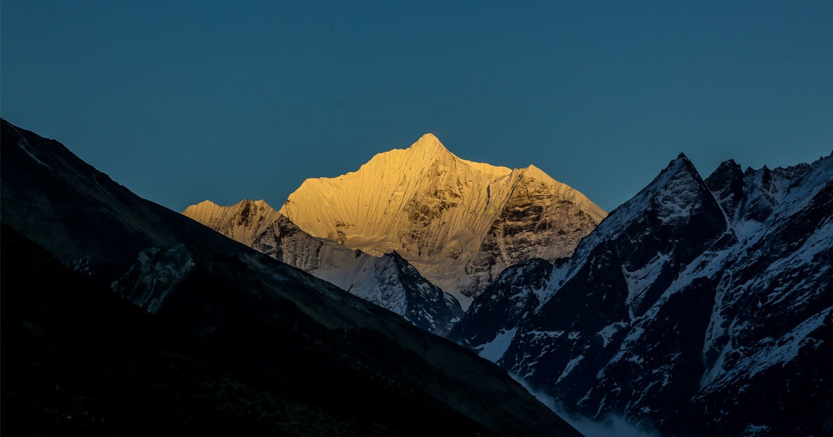
    Sun setting on Manaslu Peak looking like gold
    Manaslu Sunset

    Breathtaking Landscape Of Manaslu Trek

    A varied landscape is experienced in the Manaslu Circuit from the gigantic sheer ridges and alpine pastures to the low valley’s terrace fields and subtropical rainforests. Trekking transports one through gorges of the Budhi Gandaki River and subsequently to Larkya La Pass (5,160 m) – Nepal’s highest and most stunning mountain passes with staggering altitude. On the way, one can see the panoramic view of Mount Manaslu, Himalchuli, Ngadi Chuli, and other white mountains, and the horizon. Why Manaslu Circuit Trek?

    Fewer “trekked,” to trek the Annapurna Circuit — re-trek, re-trek-and-re-trek again, for the Everest Base Camp trek. Paradise of Nature — from the world’s highest climbing passes to rainforest subtropics — and the adventure of in-your-face monasteries and villages, Tibetan-style. Part of the reason why Manaslu Circuit is one of Nepal’s most popular trekking holidays:

    As might be anticipated, this is a longer explanation of what one will find within each experience, so people will understand that the Manaslu Circuit Trek in Nepal is worth doing:

    1. Fewer tourists than in tourist areas

    There are many fewer tourists on the Manaslu Circuit than tourists at most major tourist destinations, such as Everest Base Camp or Annapurna Circuit treks.

    This is also owing to the fact that it is a closed district, and therefore you will need a special permit and a licensed guide. You will hence be unlikely to spot tourist hordes, tourist hordes waiting at queues of teahouses, or tourist commodification base camps here. Remoteness will give you the peaceful trekking experience whereby you will get a chance to behold the peace and intimacy of the Himalayas with no interruption.

    2. Evasive contact with the indigenous Gurung and Tibetan

    Manaslu is a blend of indigenous ethnic Gurung and Tibetan-Buddhist inhabitants, living in a primitive state.

    Old monasteries, prayer flags, mani walls, and yak herders give one a glimpse of centuries-old Tibetan cultures making their way through villages such as Lho, Sama Gaun, and Samdo. People here are kind and extremely welcoming, easily inviting strangers into homes or teahouses. You’ll witness monastic rituals, sample local foods like tsampa and butter tea, and hear the hum of chants echoing from monasteries high in the hills.

    3. Remote landscapes with pristine views

    The Manaslu Circuit trek is one to leave you agog, a trek that starts at the craggy gorge of the Budhi Gandaki river (lower side) and goes on through onto the glacial Larkya La pass (5,160 m) on the higher side. The trek is an eyeball slideshow of all you wish for the Himalayas. You ride up and down along green jungle, walk across suspension bridges over torrent rivers, and ascend up through white-capped peak-fringed glacier valleys. You catch glimpses of Mount Manaslu, Himalchuli, Ganesh Himal, and Ngadi Chuli — Himalayan giants. Since it’s not touristy anymore, the scenery is completely unspoiled, and you get that great feeling of being in a far-off and non-touristy Himalayan country.

    4. Challenging and varied terrain

    The trek doesn’t just offer scenery; it tests your capabilities to trek. On a quite straightforward direction hike, you’ll be gaining immense altitude on very steep terrain, and that is as much acclimatization as it is endurance. The hike has seen it all: rock step, field terracing, forest road, rock crest, to cross-altitude. The coup de grace is the Larkya La Pass — an uphill slog, most likely in the snow, and stunning vistas down the Manaslu range and the Annapurnas.

    5. Incredible biodiversity within the Manaslu Conservation Area

    The trek passes through the Manaslu Conservation Area, a protected area which is also one of the largest and most varied ecosystems in itself. Tours along lush canopy forests of pine and rhododendron with a supportive variety of avifauna at lower altitudes.

    Breathtaking diversity of threatened Himalayan wildlife and vegetation inhabits his region. Encounters of Himalayan tahr, blue sheep, and snow leopards have all been had at least. Once the area is famous for medicinal herbs and has been reported to have over 110 bird species, and an innumerable number of butterflies and reptiles for nature enthusiasts to relish.

    Monastery & Mt. Manaslu in the background
    Manaslu

    Trek Overview

    • Duration: 14–18 days
    • Altitude: 5,160 meters (Larkya La Pass)
    • Difficulty: Moderate to Difficult
    • Best Climbing Season: March–May, and September–November
    • Permits: Restricted Area Permit, Manaslu Conservation Area Permit (MCAP), and Annapurna Conservation Area Permit (ACAP)

    Getting There: Starting the Journey

    Your journey begins with a scenic drive from from Kathmandu to Soti Khola or Machha Khola through countryside villages. The river along which you will be trekking is born in the district of Gorkha, homeland of the Gurkhas. The trek is a uniform climb over uniform slopes of forest, waterfall rock faces, hillside pasture ridges, and terraced farms with good views of the villages.

    Day-by-Day Highlights

    Day 1–3: Machha Khola to Jagat

    Lower sections of the trails are through jungles, suspension bridges, and warm riverside villages. You´ll be camping at Tatopani, which is well-known for hot springs, and Jagat, officially the beginning point of the Manaslu Conservation Area and a UNESCO village.

    Day 4–6: Jagat to Namrung

    The drama level reached here is gorges, cliff-hanging paths, and the Tibetan Buddhist cultural way of life is added to. Surrounding all the while with varieties of stone chortens, mani walls, and prayer wheels. Namrung village is an appropriate acclimatization place, and nice vistas of Mount Ganesh Himal and Mount Himalchuli await you.

    Day 7–9:Namrung to Samagaun

    With every step up, there is an opening out to Alpine meadows and snow-tipped summits. Lho village’s finest view of Manaslu and picturesque Ribung Monastery is the most photogenic section of the trek. The trek continues to Samagaon village with distinctive culture and welcomes the Pungyen Gompa and acclimatization day hike to Manaslu Base Camp (4,800m) or Birendra Lake.

    Day 10-11: Samagaon to Samdo

    As you ascend the ridgeline past tree line and into more remote country, Samdo, which is the highest of any year-round village in the region, so a fine place to take a break before the physically strenuous portion of the trek, the Larkya La Pass.

    Day 12: Larkya La Pass (5,160m)

    It is because of this that you have come to witness: the Manaslu Circuit. Returning from a challenging and arduous trek to Larkya La Pass, looking back over your shoulder at the majesty of high-mountain peaks, Himlung Himal, Cheo Himal, Kangguru, and the view of Annapurna II is breathtaking. Your descent is to Bimthang, where you can relax in an unspoiled valley.

    Day 13-15: Steep Down to Dharapani

    The trail gradually descends through rhododendron forest and ancient Gurung villages like Tilije and Dharapani, where you will be on the Annapurna Circuit coming down to Dharapani. You will ride a jeep or bus from there back to Kathmandu.

    Yes! Your Cultural Encounters along the Manaslu Circuit Trek are rich and deep in numerous ways.

    Cultural Encounters on the Manaslu Circuit

    Perhaps the best thing about Manaslu Circuit trekking is seeing embedded living cultures in the Himalaya. More developed trekking areas have examples of sanitized flashes of rural culture. Manaslu offers raw photographs of living traditional cultures, which seem to have been less affected by recent development.

    manaslu mountain
    Mt. Manaslu

    Two Major Ethnic Groups

    1. Gurungs in the Lower Hills

    You have already begun trekking at lower elevations — Soti Khola villages, Machha Khola village, and Jagat village — and are already trekking on the route to Gurung village. Gurungs are indigenous inhabitants with an:

    • Agricultural lifestyle: Terracing cultivation, pastureage, and village-level trade
    • Express tradition and language
    • Physical proximity to nature and animist spirituality, which is typically typical of Hinduism or Buddhism
    • They share a proud military tradition with the British and Indian Gurkha regiments.

    Nepali rural life embraces the villages, and the creaking door is flung open in a smile, and rural life is given.

    2. Nubri and Tsum People in the Upper Valley

    As you walk along to Lho, Sama Gaun, Samdo, and a little further beyond, you are amidst the Tibetan-inhabited Nubri and Tsum valleys. They use Tibetan languages, wear traditional Tibetan clothing, and live in stone houses built in a way to eliminate the mountain cold climatic influences.

    • It’s all actually controlled right up to the very last place by Tibetan Buddhism, and it permeates all aspects of life. You will find
    • Town and local citizen-ornamented Mani stones and town wall prayer wheels adorned with Buddhist mantras such as “Om Mani Padme Hum”
    • Gateway and chortens (stupas) standing at the cusp of the spiritual, religiously demarcated: atop hills, or over even towns.
    • And a couple more stunning monasteries, like those looming over Lho’s Lho or the Sama Gaun town.

    These monasteries are worth the journey alone for hillside scenery and religious ritual, painting,g art, and devotion.

    Daily life and spiritual practice

    Religion is an integral part of life here in the hill towns. You will see:

    • Monks and nuns reciting mantras or performing rituals
    • People moving hand to hand or chortens spinning prayer wheels as a regular religiosity
    • Every-colored prayer flags blowing across tops and passes, supposedly swept away on blessings by the wind

    It is rich in experience to walk around the area at festival time — i.e., Lhosar (Tibetan New Year). Festivals are:

    • Cham, monk in mask’s evil-warding dances
    • Drumming, conch shell, she’ll, and horns
    • Socializing, feasting, and singing in the open courtyard
    Lho Village & Manaslu mountain in the background
    Mt. Manaslu

    Permits and Regulations

    The Manaslu area is a restricted zone, and thus, you’ll require a registered trekking agency and a minimum of two trekkers accompanying you to obtain permits. The following are the ones that you would require:

    Manaslu area being a restricted zone, the following permits would be required:

    1. Restricted Area Permit (RAP)

    • Issued by the Government of Nepal
    • Minimum of two trekkers and a licensed guide

    The fee varies by season:

    • September to November: USD 100 for the first 7 days, USD 15 per day thereafter
    • December to August: USD 75 for the first 7 days, USD 10 per day thereafter

    Manaslu Conservation Area Permit (MCAP)

    • Fee: NPR 3,000 (approximately USD 25)

    2. Annapurna Conservation Area Permit (ACAP)

    Necessary since the trail ends in the Annapurna region

    Fee: NPR 3,000 (approximately USD 25)

    Note: Trekkers do not need a TIMS (Trekkers’ Information Management System) card for the Manaslu region.

    Best Time of the Year to Trek the Manaslu Circuit

    1. Spring (March to May)

    Rhododendron blooming season, ideal weather, and great views. The best season for photographers and nature enthusiasts.

    2. Autumn (September to November)

    Ideal time for the Manaslu Circuit, with ideal weather, clear blue skies, and dry trails. Best season to cross high passes.

    3. Winter and Monsoon

    Avoid the monsoon months of June–August because of landslides and bad weather. December to February is bitterly cold, and Larkya La Pass can be snowed over.

    What to Take on the Trek

    Such a high and such a remote trek deserves good gear. The following gear must be carried:

    • Layered clothing (base, mid, and shell layers)
    • Insulating layers anda down jacket
    • Gaiters and strong trekking boots
    • Sleeping bag (-10°C rated or colder)
    • Water purification tablet or filter
    • Headlamp, trekking poles, sunglasses
    • Altitude drug in the first-aid kit
    • Snacks, energy bars
    • Reusable water bottle

    Accommodation and Food

    You will be sleeping in teahouses — small, locally run lodges that offer simple accommodations and good food. Not luxurious by any stretch, but warm, and the welcome is warm.

    Meals typically include:

    Dal Bhat

    Dal Bhat is Nepali staple cuisine and consists of steamed rice, lentil soup (dal), and seasonal vegetables, fresh in nature. Pickles, and sometimes meat, is consumed at lower altitudes. Dal Bhat is energy and nutrient-providing food and thus the best during treks of long durations. Unlimited refills is the norm at most tea houses and thus a trekker’s favorite dish.

    Tibetan Bread

    Tibetan Bread, a flat fried bread that is crispy on the outside and soft in the middle. Eaten every day with jam, honey, or eggs for breakfast. Filling, tasty, and gives instant energy. Found everywhere on the trekking trail.

    Momos

    Momos are vegetable, meat, or cheese-filled dumplings served with hot sauce. They’re the staple light meal or snack of the mountain people. Served steaming and hot, they’re an ideal lunch for a quick bite. Vegetarian momos are more readily available at higher altitudes.

    Noodles and Pasta

    Chowmein (noodle fry), thukpa (noodle soup), and pastas like spaghetti are on the trek. They are freshly prepared with vegetables or occasionally with meat. Thukpa is very comforting on cold days. They are light to digest and just right for a fill-up.

    4. Porridge and Pancakes

    Staple breakfast porridge is prepared using oats or corn flakes and consumed with fruit. Flavored pancakes, apple, banana, or regular ones, are consumed with jam or honey. They are refreshing and light. They’re warm, quick to prepare, and quick to transport anywhere.

    5. Eggs and Toast

    Boiled, scrambled, or as omelets, eggs are simple but delicious and served with chapati or toast. It’s a sure-shot breakfast of protein and carbs. Toast with cheese or jam can be served in certain lodges. It’s a sure thing, a favorite of most trekkers.

    6.Hot Drinks

    Hot drinks are black tea or milk tea, ginger, lemon, or mint tea, and instant coffee. Lemon with honey is comforting and very common at high altitudes. Hot chocolate or herbal teas can be found at some places as well. The best to be hydrated and warm on the trail is these drinks.

    As you ascend, food variety decreases and prices increase due to limited transport access.

    Accommodation on the Manaslu Circuit Trek

    Manaslu Trek lodges are basically tea houses, small family homes. Basic, although some of the bigger villages offer a mid-range level of comfort. The tea houses offer a warm bed to sleep on, some porridge to eat, and some other trekkers to chat to. They are a local culture trekking community.

    Rooms

    Twin rooms are dormitory-style and have wood beds, foam mattresses, pillows, and woolen blankets. Twin rooms are not insulated and do not have indoor heating, so twin rooms become freezing cold at night. It is better to bring a waterproof sleeping bag. The room space is not roomy, but sufficient for sleeping.

    Toilets

    Toilet facilities vary from high to lodge level. Western flush toilets are at lower levels. Squat toilets and communal toilets are what you will find higher up. You’re better off carrying toilet paper and sanitizer with you.

    Hot Showers

    They do have showers at some of the tea houses. They are sun or gas-heated showers and will cost an extra $2 to $5. Hot water or maybe no hot water at high elevation, since it will freeze.

    Electricity & Charging

    Power is usually available in most villages from the national grid or solar panels. Recharge is usually extra charge per device or per hour. Power banks or solar chargers are a backup, which keeps you online without having to use lodge facilities.

    Wi-Fi

    Wi-Fi is spreading to places such as the village of Samagaun, Lho, and Namrung. It is going to be slow, unreliable, and not even worth paying extra money for as an option. Some of the trekkers do not even require the internet and have only scenery to gaze at from the surroundings.

    Dining Area

    Each of the tea houses has a dining room, normally the least formal room in the house. All of them have a bukhari stove in the middle, which is lit in the evenings to heat up the room. The room is not just used for eating but for relaxation, conversation, and planning tomorrow’s excursion.

    Physical Preparation and Acclimatization

    The hike is a strenuous, steep climb and high altitude. Prepare yourself in the following way:

    • Begin preparation at least 2 months earlier
    • Backpack trek
    • Get your heart, body, and endurance conditioned via cardiovascular, strength, and endurance training.
    • Train to identify altitude sickness
    • Acclimatize wisely — rest and drink water in abundance
    View of Birendra lake & Samagaun village from Manaslu Base Camp
    View from Manaslu Base Camp

    Responsible Trekking in the Manaslu Region

    This remote region is vulnerable ecologically and culturally. Be a responsible trekker by:

    • Not carrying refillable bottles of water in plastic
    • Proper disposal of environmental waste
    • Not being offensive to the local culture,a nd first seeking permission to photograph
    • Having meals at the local teahouses and buying local handicrafts
    • Employing local porters and guides for community development

    Conclusion: Why Manaslu Is a Life-Changing Trek

    Manaslu Circuit Trek is not a human body odyssey alone, but an odyssey of faith and culture too. Without anything more than stunning views of mountains, abundant culture, and an atmosphere of untouched wilderness, it’s one of Nepal’s greatest trekking sagas. If you seek a manner that is long and distant, secluded, Manaslu calls you to your subsequent Himalayan odyssey. Contact us today at Happy Mountain Nepal, on Facebook, Instagram, or TikTok


  • UNESCO World Heritage Sites: Highest Density in the World

    UNESCO World Heritage Sites: Highest Density in the World

    UNESCO World Heritage Sites: Highest Density in the World

    And if everything in nature is in balance, then culture and history itself is in balance, and there simply are some countries more precious than others. Is not Nepal one of them with the highest UNESCO World Heritage sites in the world? Himajan beauty gives the nearest estimation to the most concentrated dose of such beauty with so-called ultimate respect to all of the human mankind to be good and close to one another.

    We will explain in this blog why are the UNESCO World Heritage Sites unique, why is Nepal unique, and more about those incredible sites.

    Mountain city & jungle view
    Langtang, Bouddha & Chitwan

    What Is a UNESCO World Heritage Site?

    There are some locations on our planet that have been marked by UNESCO, one of the United Nations Educational, Scientific and Cultural Organizations, as World Heritage Sites. This can be monuments or cultural, scientific, historical, or natural sites of significance. They are not for use or enjoyment today, but for preservation for generations in the future.

    They fall into three categories:

    • Culture: Historic structures, cities, buildings, or traditions.
    • Nature: Geography, geology, or environment.
    • Mixed: Both culture and nature.

    Why Nepal ranks second with highest number of UNESCO Sites in the world

    Nepal is a small country, but inside the small country there’s amazing diversity. It has ancient cities, sacred temples, and high-altitude mountain parks, so Nepal is an open museum. Nepal has ten World Heritage Sites in the UNESCO list, and eight of them are within 60 kilometers of the Kathmandu Valley. There’s one of the most densely populated cultural areas of.

    The 10 UNESCO World Heritage Sites of Nepal

    1. Kathmandu Durbar Square

    Palaces of Shah kings and subsequently Malla kings, Kathmandu Durbar Square or Hanuman Dhoka Palace Complex is right in the center of olden Kathmandu. Containing only a palace complex, temples, courtyards, and statues, the square is an architectural marvel with Newar architecture in the form of latticework windows, wood carvings adorned with decoration, and tiered pagodas. Politically and culturally as well, Kathmandu Valley seat of government, coronation and celebration were here.

    Even though this complex has also been affected by the 2015 earthquake, there is no single damaged building or, worse even, a single casualty in this complex. Kumari Ghar (Palace of Living Goddess), Hanuman Dhoka Museum, and Taleju Temple are some of the world-famous places within this complex. This complex is also decorated with Hindu as well as Buddhist elements, so not only an ancient complex, an ever-lasting culture center too.

    Golden sky with Kal Bhairav statue & Kathmandu Durbar Square
    Kathmandu Durbar Square

    Key Points:

    • Palace of Shah and Malla monarchs,
    • House of Living Goddess Kumari,
    • Newar style of construction similar to woodcarvings,
    • Has traditional festivals such as Indra Jatra,
    • Is located in the center of Kathmandu.

    2. Patan Durbar Square

    Patan Durbar Square is located in the middle of Lalitpur city, previously known as Patan. It is renowned for having extremely well-preserved palace complexes, temples, and shrines. Although it was established as a learning and artistic center by the Malla kings, it is decorated with plenty of carvings, metal, and stone carvings. Among them, the most popular one is Krishna Mandir, which had been constructed completely of stone in Shikhara style.

    The square is also home to the Patan Museum, South Asia’s premier Hindu and Buddhist art museum. It’s a city of artisans, and artisans make handicrafts in family workshops where ancient crafts still exist. The city isn’t modernized yet, though, and still has a clean eternal sort of quality timeless past and timeless present.

    Patan Durbar Square view with temples
    Patan Durbar Square

    Highlights:

    • Krishna Mandir: constructed all of stone,
    • Patan Museum: with faith paintings,
    • Centre for Newar art and architecture,
    • Some pagoda and Shikhara-type temples,
    • Fewer tourists than Kathmandu.

    3. Bhaktapur Durbar Square

    Bhaktapur Durbar Square is Nepal’s most preserved medieval town. 13 km from Nepalese capital city Kathmandu, formerly a kingdom overawing the latter, stands Bhaktapur today. Emerging from such archeological splendors as 55-Window Palace, Golden Gate, and Vatsala Temple, cobble-road thoroughfares, buildings a hundred years old, and colorful town courtyards preserve within themselves an ever-eternal-world glory that whisks you back in the 15th century.

    Bhaktapur is renowned for its weaving and pottery, and traditional practice remains retained till date. Reconstruction of buildings even post-2015’s earthquake was undertaken to provide the city with an identical old look. Bhaktapur is distinctive not just due to monuments but also due to heritage.

    night view of Pyatapola at Bhaktapur Durbar Square
    Nyatapola Temple


    Major Points:

    • 55-Window Palace with façade decoration
    • Golden Gate: finest example of repousse metalwork
    • Lively community of craftspeople
    • Medieval Newar urban planning
    • Organizes the big composite festivals such as Bisket Jatra.

    4. Swayambhunath Stupa (Monkey Temple)

    Atop a hill in the northwestern corner of Kathmandu, Nepal, is this most sacred and oldest Malla complex of Hindu and Buddhist devotion. The white middle stupa and all-seeing eyes of the Buddha and the golden finial of enlightenment represent enlightenment. Different clusters of small shrines, chaityas, and temples are scattered here and there on the grounds to represent centuries of human spirituality.

    The hilltop gives a bird’s eye view of the Kathmandu Valley, and the complex is everyone’s delight, both for the tourists and the locals. Smell-running monkeys are the delight of the complex. The combination of Swayambhunath architecture and spirituality is proof of Nepalese diversity.

    Swyambhu & Harati Ajima seen in Swyambhunath temple
    Swyambhunath

    Key Highlights:

    • One of the earliest stupas of Nepal, more than 2,000 years old)
    • All-knowing eyes of the Buddha reflect awareness.
    • Panoramic view of Kathmandu Valley
    • Sacred to Hindus and Buddhists
    • Nickname because ofthe resident monkey colony

    5. Boudhanath Stupa

    Boudhanath is the largest and most significant stupa on the planet. It’s a Tibetan Buddhist sacred spiritual complex, located north of the capital city of Kathmandu. The gigantic white dome, surmounted by a gold spire and Buddha eyes that seem to be staring back at you, exudes an aura of serenity and mysticism. Monks and pilgrims walk the other direction around the stupa, chanting mantras and spinning prayer wheels.

    It’s surrounded by Tibetan monasteries and bazaars, and the area is mostly Tibetan. It’s especially crowded during Buddhist holidays like Buddha Jayanti and Losar. Boudhanath is a vibrant spiritual community and shrine, and is full daily with thousands of pilgrims.

    Bouddhanath Stupa
    Bouddha Stupa

    Highlights:

    • Largest stupa in Nepal
    • Center of Tibetan Buddhist culture
    • Prayer wheels circumambulation path
    • Surrounded by shops and monasteries
    • Hollow, but is a center of meditation quietly

    6. Pashupatinath Temple

    With all the sanctity that has been bestowed upon it, Pashupatinath is Nepal’s most sacred Hindu temple on the river Bagmati in Kathmandu. Pashupatinath temple is Lord Shiva’s temple and a massive 500 or even larger temple, monuments, and ashrams. With a golden roof and silver gates being engineering wonders, the temple is only open to Hindus.

    It is also one of the humongous cremation grounds where open funeral ritual takes place every day. All of this in accordance with Hindu cycle of birth and death. Thousands throng there during Maha Shivaratri and one of the largest celebrations of the country.

    Pashupatinath Temple view from bagmati ghat
    Pashupatinath

    Key Points:

    • Nepal’s most sacred Hindu temple
    • A temple in which Lord Shiva is worshipped
    • Open cremation is performed on the river ghats.
    • Mad crowd during Maha Shivaratri
    • Green blend of art, ritual, and religion.

    7. Changu Narayan Temple

    Changu Narayan temple is Nepal’s oldest extant Hindu temple, located on the hillside which hangs over Bhaktapur. The temple is itself a temple to Vishnu and was constructed during the 4th century. The temple precinct includes some of the carvings from wood and stone which are some of the best of the remaining Nepalese artwork from an early period. Though the temple is very ancient, it is an active center for worship.

    The village that is nearby also provides a first-hand Newar village experience. As it is not as touristy as some of the other heritage sites, the site is a wonderful one for those who require some peace contemplation. It also provides lovely views over the greens and valley.

    oldest Changunarayan temple
    Changunarayan


    Key Highlights:

    • Oldest surviving Hindu temple in Nepal
    • Votive temple of Vishnu (as Narayan)
    • Well-carved and inscribed fine stones
    • Quiet village atmosphere
    • Good view of Kathmandu Valley

    8. Birth place of Lord Buddha in Lumbini

    Original Buddha birthplace is situated in Nepali plains, southern region. Real birthplace it is, but holy pond, Ashoka Pillar are available rather the real birthplace being tranquil Maya Devi Temple and hence the sense of spiritual experience.

    It is appears to be divided into East (Theravada) and West (Mahayana) with overseas monasteries. Pilgrims come to meditate, study, and bask in silent reflection. Lumbini is not only an ancient site; it’s a throne of peace and divine non-violence.

    Mayadevi Temple in Lumbini
    Lumbini

    Highlights:

    • Birthplace of Buddha (623 BCE)
    • Maya Devi Temple and sacred pond
    • Ashoka Pillar with historical visit record inscription
    • International monastic zone
    • Declared world pilgrimage site

    9. Sagarmatha National Park

    Sagarmatha National Park borders Nepal in the east and includes Mount Everest, or Sagarmatha as the locals call it. It is 1,148 square kilometers of rugged mountains, gorges, glaciers, and backcountry. It is a UNESCO natural heritage site because it includes huge diversity and cultural landscape.

    The. Sherpa people, the park. is dotted with monasteries, prayer flags, and Everest. trails. Snow leopards and Himalayan tahrs give way to wild forest dwellers. Nature beauty and religious warmth are the charm of trekking here.

    visitors at Everest Base Camp
    Everest Base Camp

    Main Features:

    • It is one of the home of Mount Everest.
    • Rare Himalayan flora and fauna species
    • Sherpa people and Buddhist monasteries
    • Evergreen trekking landscape
    • UNESCO Natural World Heritage Site

    10. Chitwan National Park

    The Chitwan National Park is Nepal’s initial subtropical lowland national park. It is best known for being wonderfully varied and containing threatened species such as the one-horned rhinoceros, Bengal tiger, and gharial crocodile. Rivers, grasslands, and sal forest infested with population comprise the park.

    Jeep safari, canoeing, and bird watching facilities are available among others. Cultural tours within and beyond the region are also available in Tharu village community locations in the region on community-based tourism conditions. An eco and wildlife success story.

    safari activities in green chitwan national park
    Safari at Chitwan National Park

    Key points

    • Green one-horned rhino and Bengal tiger
    • Nepal’s first and only national park since 1973
    • Jungle safaris and canoeing trips are run
    • A UNESCO Natural World Heritage Site
    • Abundant in the culture of the indigenous Tharu people

    Travel Tips for Visiting UNESCO Sites in Nepal

    1. Plan

    Nepal’s UNESCO sites are one after the other and just a few minutes’ drive from each other, so if you can plan your days in this manner, you can cover Kathmandu Durbar Square, Patan Durbar Square, Bhaktapur Durbar Square, Swayambhunath, Boudhanath, Pashupatinath, and Changu Narayan within two or three days.

    2. Dress modestly

    Dress modestly when visiting religious and spiritual centers such as temples and stupas, i.e.: cover shoulders, chest, and legs. The exposing of one’s body is not appropriate in these cultures and results in unintended offense. Visitors generally remove shoes when walking around temple complexes, while avoiding some areas off-limits to non-Hindus and photography.

    3. Employ a local guide

    A local guide whom you employ in the destination where you will be visiting is able to bring depth of insight to your cultural and historical knowledge of the sites. You cannot gain the insight from viewing the sites yourself that a guide can provide from an explanation of symbolic temple imagery, local myth, and heritage. A local guide will also help the local economy and can make your experience in your travel better.

    4. Be Responsible

    Ecotourism will help maintain Nepal’s heritage for the generations to come. Do not throw litter, use a water bottle and refill wherever and whenever possible, and wherever possible, travel with locals. Be considerate of local religious customs, request permission before photographing a person, and purchase handicrafts to generate income for the locals.

    Conclusion

    Nepal is compact and a World Heritage tapestry like nowhere else. Icy Everest peaks, serene Lumbini plains, each site relates a story of human heritage, spiritual enlightenment, and oneness with the universe.

    Being a cross-cultural, authentic, and discovery-focused traveler, the World Heritage Sites of Nepal offer something you won’t find elsewhere—a complete package in a compact, tight bundle. Contact us today at Happy Mountain Nepal, on Facebook, Instagram, or TikTok


  • Three Passes in Everest: Ideal for Adventure Photography

    Three Passes in Everest: Ideal for Adventure Photography

    Three Passes in Everest: Ideal for Adventure Photography

    Nepal’s Three Passes Everest trek is an experience of a lifetime for dedicated trekkers and photographers and offers some of the world’s most breathtaking scenery in the highest mountain range on earth, unspoiled beauty, alpine severity, and living cultures. Whether you’re an adventurer looking for your next high or photographer looking for real awe-inspiring landscapes, the Three Passes trek is one you’ll never forget.

    Here, in this blog, we will be discussing why the Three Passes trek is a non-typical adventure photography experience compared to the rest of the treks of the region, why the trek is unique, how and when to do it as much as best time and, tips on how to make it happen for you along the way.

    Three Passes Trek

    What is the Three Passes Trek?

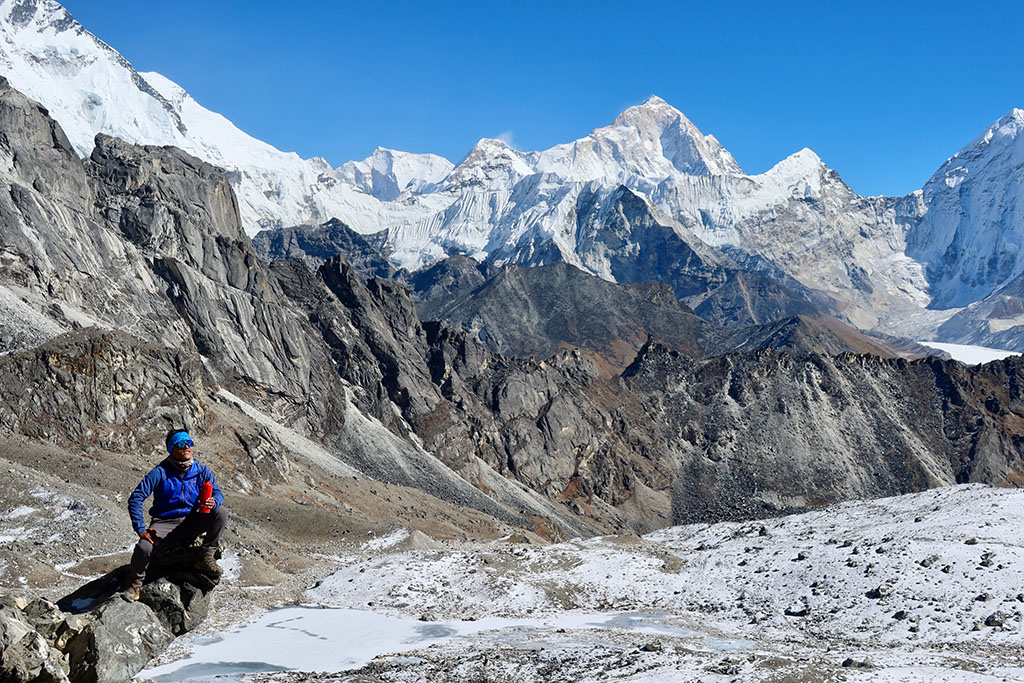
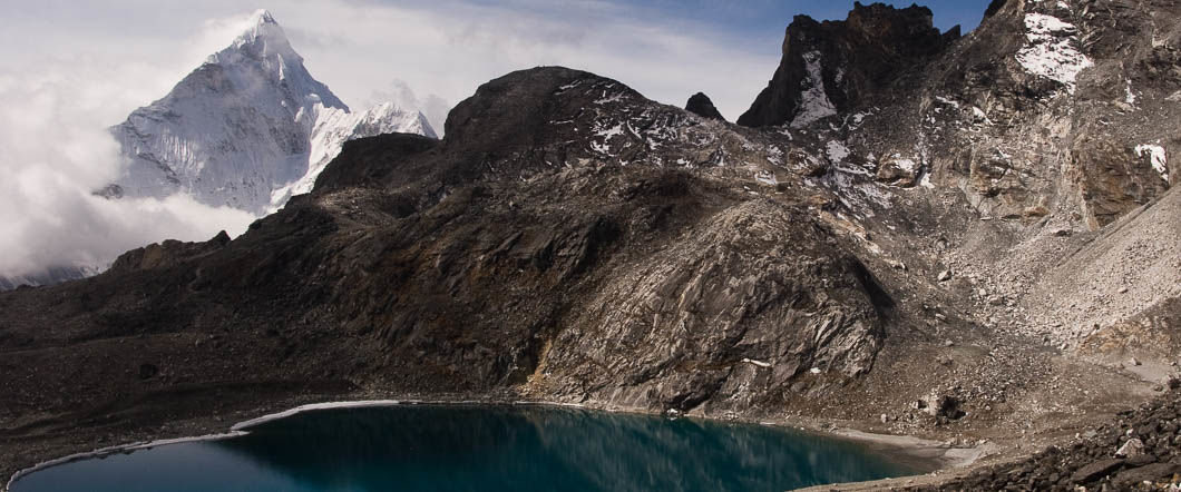
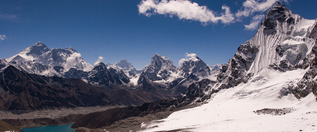
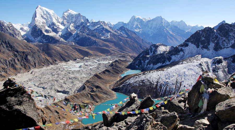
    Three Passes trek is a high altitude trekking tour in Nepal with three high mountain pass crossings of the Everest region, i.e., Kongma La (5,535m / 18,159ft), Cho La (5,420m / 17,782ft) and Renjo La (5,340m / 17,520ft). The trek is one of the most satisfying but challenging treks of the country, apart from providing the trekkers with stunning views of Mount Everest, Lhotse, Makalu and other peaks, also provides pristine landscape of the Khumbu valley.

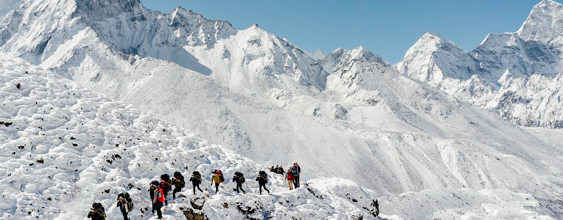
    It is longer and more challenging than the standard camp (EBC) trek and requires greater physical conditioning and technical expertise. It is of 18-22 days depending on the route followed and is marked by trekking on challenging trails such as glaciers, rocky ridges, and snow passes.

    Below is a very brief overview of each of the three passes of the Three Passes trek:

    1. Kongma La (5,535 m / 18,159 ft)

    The Kongma La is the highest trekking pass and provides one of the most challenging but gratifying experiences for trekking adventure seekers. It is a steep and rocky pass situated between the Lobuche and Chhukung valleys and demands physical stamina as well as technical know-how, particularly in winter or spring when snowfall accumulation renders the route even more challenging to climb. Kongma La ascent is walking on rock trails, loose scree, and snow, but once the top is achieved, the scenery is ispicture-perfectlyy stunning. Panoramic vistas of Everest, Lhotse, Nuptse, and other neighboring peaks from the summit are a photographer’s delight to capture outstanding high-altitude photographs. Climbing the summit of Kongma La is tiring, but the thrill of doing this pass is indescribable. The trek to the pass is a great trek and one of the most stunning mountain views on the entire trek.

    1. Kongma La (5,535 m / 18,159 ft)

    The climb down from the pass to the other side to Chhukung is half a day and has great photographic opportunities of eroded Khumbu landscape, its snowy peaks, and alpine landscape. As the pass is very high, the trek itself also provides very good photography opportunities of glaciers, saw-tooth ridges, and glacial valleys off the beaten track in the lower and tourist areas of the nation.

    2. Cho La (5,420 meters / 17,782 feet).

    The second of the Three Passes trek, Cho La, is also possibly the most challenging trek physically, as it involves steep slopes, rock faces, and ice plateaus. It is not far from Gokyo and Dzongla, and Cho La serves as a crucial connector between the region of the Everest Base Camp and Gokyo Valley. The route to Cho La is dangerous, especially in spring or winter when the trail can be covered with snow and therefore even more risky to walk on. The way down is also dangerous, with some of it done by ice walking and loose scree handled very carefully.But for those who make it through the Cho La, some of the most breathtaking scenery in the Everest Region awaits.

    Cho La (5,420 meters / 17,782 feet).

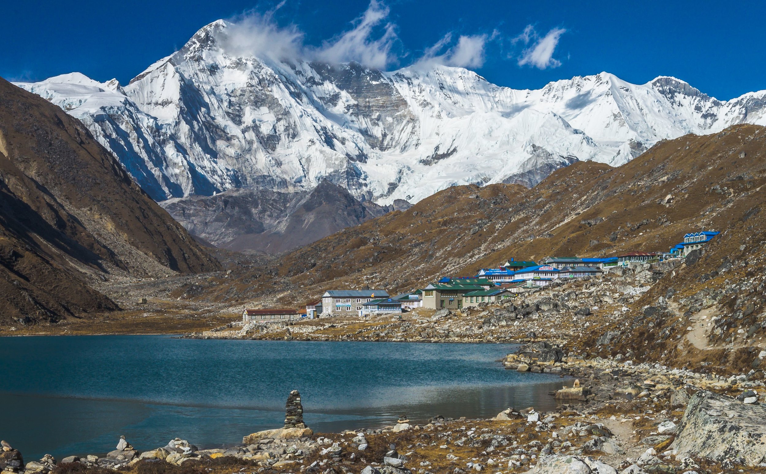
    Cho La has some very dramatic moments of theatre to be filmed on celluloid. Climbers are transported over the pass on alpine-sized ice, rock face, and lakes, with occasional glimpses of Everest, Lhotse, and other grand ridges in the vicinity. The second half of the day provides an open landscape that is ideal for wider shots, where you can capture not only the summit of the mountain but also an unbroken wilderness view below. Blue-green lakes and the tranquility of the Gokyo Valley are even more awe-inspiring after having struggled to cross the pass. Landscape and isolation of Cho La are two of the most rewarding passes to capture on this whole trek.

    3. Renjo La (5,340m / 17,520ft)

    The last of the last of the Three Passes trek, Renjo La, lies between Thame and Gokyo. The shortest of the three, but perilous in itself by virtue of how high it is and the awful weather. The walk to Renjo La provides stunning panorama shots of Everest, Makalu, Lhotse, and Cho Oyu, and the chance to capture the Gokyo Lakes, which mirror the snow-topped peaks surrounding them. The path to the pass is half rock-studded and steep, but also the least crowded of the three passes, so a less crowded, more personal trekking experience.

    Renjo La (5,340m / 17,520ft)

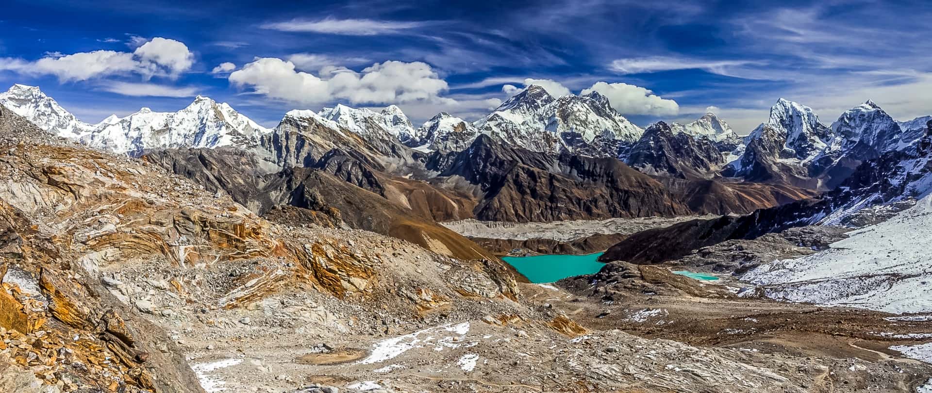
    Renjo La contains some of the finest photographs on trek, particularly of Gokyo Valley and Gokyo Lakes. The pass itself offers a great view with a panorama out over the Khumbu countryside. On a good day, you can take a photo of the entire grandeur of Everest and the surrounding peaks from Renjo La, and it is a photographer’s paradise. Renjo La is also beautiful with views of surrounding valleys and hills, and less people conditions than on the more crowded trails near Namche Bazaar and Everest Base Camp. Renjo La is therefore a perfect spot to capture high-altitude landscape shots with fewer trekkers in the scene, which a very coveted by nature and adventure photographers.

    They provide a wonderful impression of each pass, terrain, obstruction, and photo stop it offers.

    Three Passes Trek perfect for Adventure Photography

    Three Passes Trek

    1. Breathtaking Mountain Sceneries

    As you go through the passes, you are treated to unparalleled scenery of the world’s highest mountains. Mt Everest, Lhotse, Makalu, and Cho Oyu provide the background for some of the finest landscape photography opportunities in the world. Rock peaks, snow-capped glaciers, valleys, and alpine forests provide you with more than enough subjects to photograph.

    Best Photo Spots: Show Everest’s size, Lhotse’s ominous ridges, and Makalu’s appealing uniqueness from a wealth of diverse perspectives on the hike. Sunrise and sunset on these giants are magnificent in the warm light.

    2. High-Altitude Lakes and Glaciers

    Your walk comes across a series of high-altitude lakes like the Gokyo Lakes reflected by white capped mountains lining them in glittering crystal clear shine. Mirror calm lakes are ideal for pan photography to bracket a reflection shot with sky and even mountains. Ngozumpa Glacier-longest glacier of Khumba valley is another location to try and freeze peaceful nature.
    Best Camera Moments: morning photo of Gokyo Lakes if there won’t be any ripples on the lakes’ water, and reflection of about peaks can’t be evaded. Even the glacier has still another unique job to accomplish, it provides a good view of ice and a good landscape!
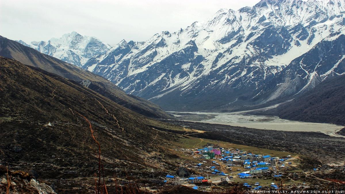
    3. Sherpa culture and Villages, something special

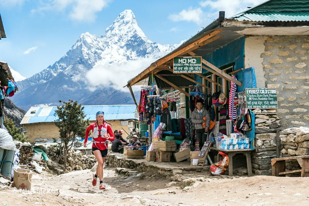
    You will be required to trek through remote Sherpa villages like Namche Bazaar, Dingboche, and Lobuche, where you might want to capture Sherpa culture and Sherpa life experiences in your camera. Villages are made up of reddish-brick-colored villages, Buddhist monasteries, and reddish-brick-colored prayer flags, with the appearance of blowing and billowing over hills’ slopes.
    Best photography scenes: Sherpa villagers dressed in their traditional attire, later used prayer wheels, and monks in local monasteries. Rich culture and hostile high-altitude environments: great photogenic dramas.

    Three Passes Trek

    4. Challenging and Diverse Terrain

    The Three Passes trek is so varied that there will never be room enough to cover it all. Mountain ridge and climbs, glacial lakes, grassy meadows, rhododendron forest – at every turn on the trek we were constantly discovering new ways of composing a photo! The ice trails/suspension bridge walk just enhances the drama of the photos.

    Best Shots: Position the trekkers in front of such titans, small suspension bridges over giant canyons, and small ridges on a monolith, a ridgeline sequence of mountains.

    5. Flora and Fauna

    Khumbu is also full of Fauna and Flora, such as the Himalayan Tahr species, snow leopard, vultures, pheasants, musk deer, etc. Flora is in large numbers, grazing over the alpine grassland, junipers, and rhododendron bushes, all of which are plentiful, having more than enough wildflowers during spring and filling your picture with more than enough colors.

    Three Passes Trek

    Best Time to Visit the Three Passes Trek for Photography

    The most favorable time of the year to visit for the Three Passes trek photoshoot is pre-monsoon (spring) and post-monsoon (autumn):

    Spring (March to May): Weather is ideal to capture the colorful flowers of the region. There are flowers in bloom, and the air is fresh with expansive hill views. Spring is very hot, and the trek is full of trekkers.
    Autumn (September to November): Blue sky and fresh air, great light, and visibility for perfect photography. Fewer rains are also experience during autumn, so it is less probable that your mountain photos will get clouded.
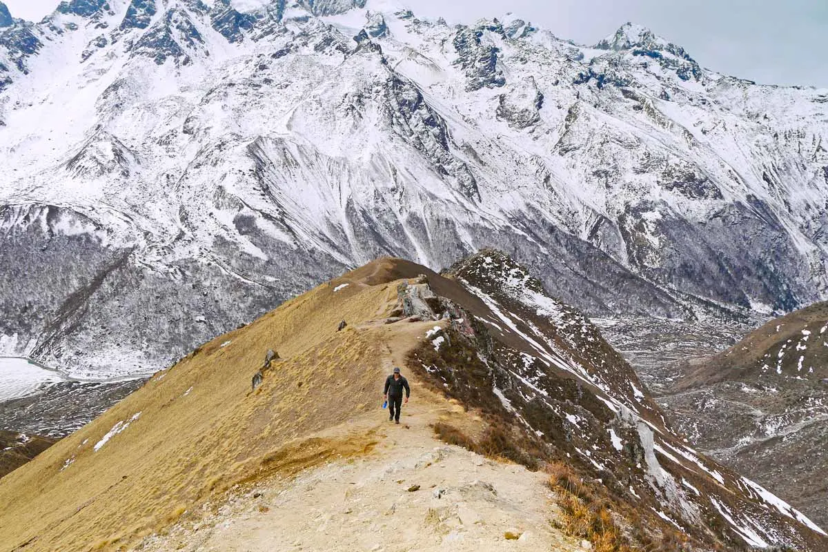
    Equipment for Adventure Trekking Photography of the Three Passes

    You need good equipment in order to capture the grandeur of the Everest landscape. Some of the must-have equipment to carry along is explain below:

    1. Camera Equipment

    • DSLR or Mirrorless Camera: Offers higher quality images and more flexibility per shot type.
    • Wide-Angle Lens (16-35mm or 24-70mm): Excellent for capturing sweeping wide scenes, mountain landscapes, and panos.
    • Telephoto Lens (70-200mm or 100-400mm): Excellent for capturing distant wildlife shots or for flying around distant summits.
    • Tripod: A travel tripod will help in capturing long-exposure shots during dawn and dusk.
    • Extra Batteries and Memory Cards: Cold batteries drain quickly, so carry plenty of spares. Carry as many memory cards as it will take to hold all your photos.

    Camera Equipment

    2. Protective Camera Gear

    Camera Rain Cover: Dry and snow-free glacier hiking or brief snowstorms.
    Lens Cleaning Kit: Dust and moisture accumulate quickly in the Himalayan environment, and so a clean lens equals tack-sharp photography.

    3. Drones (Optional)

    The drone can capture the scenery of great mountains and valleys from a higher altitude, having unobstructed vision of the area. Make sure to take note of what is regulate locally, provided it is about operating drones, and adhere to all of them.

    Photography Tips for the Three Passes Trek

    Three Passes Trek

    Photograph At Golden Hours

    Soft warm light at dawn and sunset—the golden hours—add depth, contrast, and a touch of magic to mountain landscapes. Golden hours in the Everest range give the ideal light to capture white peaks golden and pink against dark dark blue sky. Dawnlight also gives bluer heavens and less haze, ideal to put Everest and his friends in top condition.

    Use a Polarizer Filter

    Polarizing filter is a great piece of equipment for serious photography, particularly when outdoors in snowy or reflective weather like in the Himalayas. Not only does it stop glare on water, snow, and wet rock but improves the color of your landscape photo’s color so that it looks more vivid. Darkens the sky and contrasts the sky so your photos result in lighter and darker in color without needing post-processing.
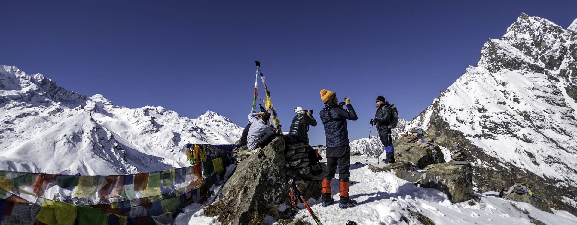
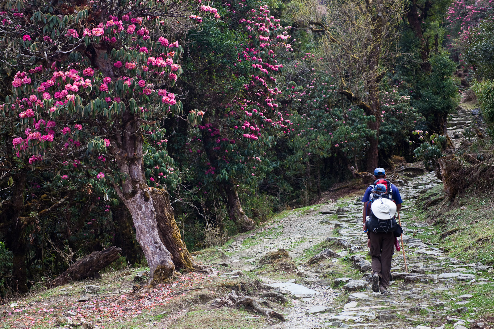
    Watch the Details.

    Other than panoramas, detail tells your travel story. Tightly cropped rock and ice, whirligig prayer wheels, or snow prints are all details so small, butthey provide variety and credibility to your video. Close-ups are what make the intimacy as well as the respite from the grandeur of wide shots.

    Be Patient and Attentive

    Light in Everestland changes, and your moment-in-time shot is already there waiting to be snap. Clouds will shroud a summit for a brief instant and lift once more; shafts of light will transform an uninteresting second otherwise into that of magic. Having the location provides one with the leeway to wait and react to the moments that exist briefly to allow one to present them as spontaneous and real.

    Be Respectful of Local Culture

    Local people and the people of the Everest region must be respect and photographed politely. First, permission must be ask before photographing a person, and, by all means, must not go inside anyone’s home or religious places. Sherpa culture is respectful and polite, and being respectful is a guaranteed method of gaining trust and authenticity in images.

    Three Passes Trek

    Conclusion

    The Three Passes trek not only requires a lot from the trekkers, but also is heaven for adventure photographers. Its highest points at high altitudes, its high-altitude lake, its Sherpa village, and the diversity of landscapes transform the Everest region into a treasure house full of endless possibilities for photographers to have the best. And if you visited there at its right time of year, bag in hand and gear, and if you sat patiently out waiting for some good photographs, then you would have been able to imagine its magnificence and beauty.

    Take your kit bag, fill your camera, and go capture some photos of the most beautiful landscapes of the world! Contact us today at Happy Mountain Nepal, on Facebook, Instagram, or TikTok

  • Langtang Valley Trek: A Journey Through Remote Landscapes 

    Langtang Valley Trek: A Journey Through Remote Landscapes 

    Langtang Valley Trek: A Journey Through Remote Landscapes 

    Langtang Valley Trek offers a great opportunity to explore one of the off-the-grid and remote areas in Nepal. Away from Kathmandu’s periphery, the trek remains independent in its rural, unexplored terrain, breathtaking high altitude scenery, multifaceted society, and tranquil asylum in Nepal’s more established treks. For experienced trekkers and beginner trekkers, the Langtang Valley Trek will remain with you.

    Langtang Valley

    Overview: Langtang Valley

    Langtang Valley lies in Langtang National Park, central Nepal, on the India-Tibet border. Langtang Valley is also referred to as the ‘Valley of Glaciers’ because the valley contains many glaciers. Treks provide you with a mix of landscape from forest, grassland, to hill mountain landscape and good views of white-piped mountains like Langtang Lirung (7,227 m), Ganchenpo (6,387 m), and Kimshun (6,365 m).

    Why Langtang Valley Trek?

    Langtang Valley is less crowded than some of the more popular treks like Annapurna and Everest Base Camp. It is one of the off-the-beaten-path treks that people must do in order to experience the Himalayas without the crowds found on some of the other Nepal treks.

    Apart from the stunning natural beauty, the Langtang Valley Trek also offers trekkers the opportunity to immerse themselves in the unique culture of the Tamang and Sherpa communities that inhabit the region. With its remote landscape, you’ll feel like you’re trekking through untouched wilderness, and the welcoming hospitality of the local people only adds to the charm of the journey.

    Best Time to Trek Langtang Valley

    March to May (spring) and September to November (autumn) are the best seasons for the Langtang Valley Trek. These seasons are the best time of the year in terms of the weather when it is clear skies, good temperature, and good scenery of the mountains. The trails are not so muddy during these seasons, too, so the trek is comfortable and easy-going.

    The monsoon season of June, July, and August must be avoided since it carries the risk of triggering factors leading to more landslides, and the winters (December, January, February) are too chilly for most of the trekkers with below-freezing temperatures and deep snow.

    Langtang Valley Trekking Route

    Langtang Valley trek is performed in 7-9 days based on your own time and schedule available at your disposal in the region. The trek may be undertaken in various sections:

    Langtang Valley


    Day 1: Syabrubesi to Kathmandu

    You start with the drive from Kathmandu to Syabrubesi village, the beginning of the Langtang Valley Trek. It is via scenic countryside, a glimpse of the field terraces, rivers, and villages.

    Day 2: Lama Hotel to Syabrubesi

    The second day of your hike is from Syabrubesi to Lama Hotel, a small resort 2,480-meter hill. The hike is in oak and rhododendron forests, extremely dense with no or little view of Langtang Lirung on the way up.

    Day 3: Lama Hotel to Langtang Village

    Day 3 hike to Langtang Village, 3,430m. View opens up gradually as one emerges from forest and alpine meadow grazing land. The closer one gets to Langtang Village, the more spectacular views of Langtang Lirung mountain, a huge peak.

    Day 4: Langtang Village to Kyanjin Gompa

    The pièce de résistance of trekking is trekking from Langtang Village to Kyanjin Gompa. Kyanjin Gompa is a cluster of monasteries at 3,870 meters above sea level, and you have fine views of neighboring peaks such as Langtang Lirung, Kimshun, and Ganchenpo. You even get a cheese factory where you can purchase some fresh yak milk cheese.

    Day 5: Kyanjin Gompa and Around

    Aside from a couple of them, no one will need an extra day to visit Kyanjin Gompa when they arrive. Tsergo Ri (5,000 meters) may be climbed and visited on foot to observe the Langtang range, or take a walk around the monastery and be serene. Acclimatization and resting will have to wait until the day.

    Day 6: Lama Hotel to Kyanjin Gompa

    After the day hike, start to descend to the Lama Hotel. Descending is the time to enjoy the beautiful scenery and the peacefulness of Langtang Valley.

    Day 7: Lama Hotel to Syabrubesi

    On the final day of the trek, trek downwards to Syabrubesi, and one can relax and rest after a successful trek. It is the reverse way you ascended, but it will give another good view of the location due to descending.

    Day 8: Bus journey from Syabrubesi to Kathmandu

    Drive back from trekking to Kathmandu in the bus. Free evening and allow your thoughts wander back on your fantastic Langtang Valley tour.

    What to Expect On the Langtang Valley Trek

    Langtang Valley Trek is equal parts sensory and spiritual discovery of Nepal’s natural beauty and cultural heritage, and a colorful trekking adventure between its peaks. In store is another revelation of what awaits on the trail:

    Scenic Beauty: An Ever-Present Companion

    But another Langtang Valley Treking highlight is size changing landscapes. And also, you’ll be able to trek through size changing placed ecological zones as you ascend, which all differ in beauty and character.

    Langtang Valley

    Rhododendron Forests:

    Thickly covered rhododendron forest dominates the trail at some points, covering it throughout the route at lower altitudes. In the event of the overlap of trekking seasons in springtime (March to May), there are high chances of viewing the trees in bloom in a palette of pinks, reds, and whites covering the country in all its glory.

    Rhododendron Forests:
    Trail leaving up into the rhododendron forest

    Rivers and Waterfalls:

    The trail is largely river-sided, and the rivers are supplied by Langtang range’s melt-down. Cross wood suspension bridges and hear the soft tap of running waters. Whims of falling waterfalls either between or after rains provide the whole scene with a near divine appearance.

    Alpine Meadows:

    Higher still, the land is wider and is made up of alpine meadows and grass slopes with splendid scenery of the gigantic mountains. Yaks and other domesticated animals graze across the meadows, adding to the countryside character of the place even more.

    Mountain View:

    Langtang Valley is surrounded by the loftiest of the range, i.e., Langtang Lirung (7,227 m), Kimshun (6,365 m), and Ganchenpo (6,387 m). These mythic hills surround you and you on the trekking trail and step by step increasingly overshadow you before Kyanjin Gompa. From Kyanjin Ri (a famous viewpoint near Kyanjin Gompa), you gaze at the whole length of Langtang in the far horizon. Something which will make an indelible imprint on your mind.

    Cultural Encounters: A Sip of Local Life

    Local Langtang Valley people are comprised of the Tamang, native ethnic villagers, who happen to be Tibetan Buddhists. You trek village to village, and what you will be viewing is a way of life that centuries ago never abruptly came to an end. What you will be able to look forward to viewing is:

    langtang valley

    1. Classic Villages

    Langtang Village and Kyanjin Gompa are real villages with cottages built in the traditional stone and waving prayer flags manner. Tibetan construction is still largely preserved in flat-roofed fashion, wooden beams, and finely cut-out windows. It is like sleeping in another world

    2. Buddhist Monasteries

    There are several Buddhist monasteries and stupas along the trek. Most popular of them is Kyanjin Gompa, which is a very small but lovely monastery at the end of the trek. These monasteries provide you with an understanding about people’s religion and culture. You even get to see Buddhist monks and locals performing prayers or rituals in monasteries.

    3. Welcome Hospitality:

    Sherpa and Tamang people are extremely well known for their welcome hospitality. Though the destination is nowhere, there are human beings, and they are extremely welcoming. You will have tea houses or their house where you can sit back and relax and enjoy a hot cup of tea or snacks, and that destination where you get a chance to witness their lifestyle, religion, and daily routine. They will give you mountains and way of life and religion, Buddhist.

    Wild Fauna and Flora: Diversification of Nature

    Langtang National Park is extremely diversified. You encounter various fauna and flora while trekking, and all of them are endangered species.

    1. Wildlife- Langtang National Park is inhabited by some of the wildlife, in the form of a cozy little family of animals, or at least the Himalayan tahr (mountain goat), the shy but fortunate little family of red pandas, and the Himalayan black bear. The birdwatcher would not go out of her mind among all that humankind and go hiking off, because the birds themselves would amble around and offer up some fashionably designed Danphe birds to romp with.
    2. Flora- Flora- It is also beautiful. In addition to the rhododendron woods that you will be walking through, you’ll walk by magnolia trees, juniper, and other vegetation of the alpine variety. Higher up on the trail, you can begin to notice that the vegetation starts to thin out, with scrub brush and hard grasses starting to take hold on the rocky mountain landscape.
    3. Glaciers and Icefalls- When going down from Kyanjin Gompa, while trekking, there are not enough glaciers and icefalls to be able to gaze at nature for her raw beauty, or so the argument goes for some. One of the better glaciers that is an exception to the rest is the Langtang Lirung Glacier which has vertical ice and snow menacingly coming down hill hill slopes.

    Spiritual Sites: A Deep Connection with the Himalayas

    If you are in front of the Langtang Valley, apart from receiving a cool, dashing sole goddess, you receive a very religious valley. The people around the Langtang Valley would be very religious in nature. There are just too many examples of religious hotspots and points of interest, and tourist spots to be seen available spread all around the region of the Langtang valley.

    Kyanjin Gompa: The Middle monasterie of Langtang Valley is the nice resting spot for you, trekkers. Stroll by from the monastery boundary field, sit and rest here and turn back and view all the body efforts you are putting and once again enjoy the view. Monastery views provide a good view of Langtang Lirung peak mountain and chortens and stupas around this.

    Prayer Flags and Stupas: There are some prayer flags with mantras along the route to the monastery. The prayers are believed to be carried by the wind to the gods. There are some prayer stupas along the route, reflecting the religious sites along the route.

    Tsergo Ri: For those with enough energy to hike over the monastery and higher still, Tsergo Ri (5,000 meters) is another lofty favorite destination which has even more stunning Langtang valley and mountain scenery. It’s at Tsergo Ri that there is a collection of mixed Buddhist prayer flags and rock piles, so it’s a sacred sacred site for local Langtang people and trekkers.

    Challenges: Physical and Mental Toughness

    While the Langtang Valley Trek is not nearly as strenuous as some of Nepal’s more popular treks, like the Everest or Annapurna Circuit treks, there will still be some physical and mental conditioning.

    • Altitude: The greatest danger of the Langtang Valley Trek is altitude. The body will get used to the lack of oxygen at high altitude in the long term. Thus, in order never to fall sick because of altitude sickness, it is very important to ascend slowly, take many breaks, and exercise utmost caution on symptoms of giddiness, headache, or nausea.
    • Weather Conditions: Weather in Langtang Valley is very unpredictable. Although autumn and spring are the best seasons to trek, there would be rain and snow at times, which would serve as an obstacle to your plan. It is always safer to expect the possibility of any such weather fluctuation to occur and carry necessary equipment with you, especially at the higher altitude of the trek.
    • Steep Slopes: There are several steep up and down sections of the trek, and that is the essence of the trek, especially to Kyanjin Gompa. Despite well-marked trails, the trekker will need to exercise caution and walk on rocky or slippery trail sections.

    A Solitary and Tranquil Experience

    The only aspect of the Langtang Valley Trek that actually sets it apart from all the others of the Nepal treks, however, is the sense of solitude and silence that permeates the region. Being as near to Kathmandu as it is, though, the valley itself is out-of-the-way and out-of-reach, with no other trekkers on the path if any. With the huge crowds dissipated, naturally, you can now get reconnected with nature and experience the tranquility of the Himalayas.

    From the white-tipped mountains to the friendly locals, Langtang Valley Trek is a complete enriching experience as much physical, cultural enriching, and spiritually introspective.

    Accommodation and Food

    Accommodation on the Langtang Valley Trek is tea houses, simple lodges with simple food and lodging. It is a dorm with a bed and blankets, but it is also wise to bring your own sleeping bag for extra comfort. Tea houses also have good local food, like dal bhat (lentil soup and rice), momo (dumplings), and Tibetan bread.

    Fitness and Preparation

    Langtang Valley Trek is challenging but moderate in level due to the steep portions of the trekking trail and altitude. Trekkers prepare for the trek by engaging in some strength exercises and cardiovascular exercise, and will get endurance and stamina prepared. Acclimatize and do not suffer from altitude sickness; hence, go slowly and drink plenty of water while trekking.

    What to Bring for the Langtang Valley Trek

    Langtang Valley Trek preparation requires careful planning with regard to the trek conditions. Among the items to pack are:

    • Good sleeping bag (one that is cold rated)
    • Ankle-supported hiking boots
    • Waterproof but light jacket
    • Warm fleecy layers
    • Hat, gloves, and sunglasses
    • Sunscreen and lip balm
    • First aid kit and altitude sickness pills (if taking them)
    • Water bottles or ha ydration system
    • Snacks and energy bars

     Conclusion: A Truly Remote and Beautiful Trek

    Langtang Valley Trek is a different experience altogether of Nepal’s stunning landscape, rural seclusion, and cultural diversity. Its stunning mountain scenery, peaceful villages, and hospitable residents are the reasons why trekking is best suited for those tourists who would like to be surrounded by the pristine majesty of the Himalayas without the throng of people that flock to other trekking places. If you are planning a hill holiday or just want to unwind, the Langtang Valley Trek is a vacation that will be the most memorable one in your lifetime. Contact us today at Happy Mountain Nepal, on Facebook, Instagram, or TikTok

  • Annapurna Circuit Trek

    Annapurna Circuit Trek

    Annapurna Circuit Trek is the world’s most popular and fulfilling trekking trail that provides trekkers with the pleasure of an enchanting mingling of virgin nature, cultural heritage, and a sit-on-the-edge-of-your-seat adventure. Being at the core of the Himalayas, the trek is a trek from start to finish, whereby you would be able to observe the emerald valleys, meadows of alpine forest, and snow-white peak mountains, and also undergo the different traditions of the inhabitants. A seasoned trekker and also an amateur trekker taking it through an adventure trail, there is something for all at the Annapurna Circuit.

    Thorang la Pass
    Annapurna Circuit trekking in Nepa;l


    Description of the Annapurna Circuit Trek

    Annapurna Circuit Trek, or simply referred to as the “classic trek,” is approximately 160 to 230 kilometers long, depending on the trek route, and starts at low Annapurna foothills and ascends as high as Thorong La Pass (5,416 meters).

    The hike is around 12-21 days in duration and varies from subtropical jungle through to alpine grass and rough dry land on the other side of the pass. The tourists would have the opportunity to view villages, monasteries, and people leading conventional lives of Gurung, Thakali, and Manangi tribes on their way.

    A Varied Landscape Trek

    Annapurna Circuit Trek is a reward-risk, varied landscape trek. Trek begins in middle of the valley at dark green dense subtropical oak and rhododendron forest. With rising altitude, the terrain has been sculpted into extraterrestrial beauty of alpine grassland, glacial brook, and bare boulders. Gradient from low to high altitude is progressive, and trekkers have luxury of acclimatization.

    Lower Annapurna

    The trekking route begins from Syange and Besisahar villages. Subtropical forests and wildlife make up this region. The trek presents smiling, warm villagers with tended fields and verdure too. Acclimatization for trekking in the Himalayas is offered by the lower part of the trek with a view of Machapuchare and Annapurna ranges in this range.

    Manang Valley

    The climbers continue climbing and climbing, and they arrive at Manang Valley. It is encircled by the Annapurna II, III, and IV mountains themselves and hence it is a resting spot as such. The climbers rest here for two days of acclimatization so that they would not be disturbed by mountain sickness. The local stone houses of the region and the Buddhist monasteries show most of the religiosity and culture of the region.

    annapurna

    Thorong La Pass

    The trekker’s trinity holy, Thorong La Pass itself at 5,416m, is challenging but exhilarating to get to. The view from the top is breathtaking, with he rolling sweep of the immediate Himalayan ridges. Snow-capped Annapurna peaks and the Tibetan Plateau in the distance are the trekker’s Eldorado in pursuit of the pass.

    Jomsom & Muktinath

    Blowing snow, freezing. Trekking to Jomsom and Muktinath through Thorong La Pass. Shelled by ruthless Tibetan soldiers, Buddhist temples, stupas, prayer flags, and monasteries. Buddhists and Hindus have both consecrated Muktinath as a holy place holy place and one single temple was built in memory of Lord Vishnu. Muktinath’s serene religious scene is a serene peak to the Annapurna Circuit Trek.

    Immersive Cultural Experience in the Trek

    The natural landscape of the Annapurna Circuit is the most spectacular attraction, yet the experience of culture one gets while trekking there is equally invaluable. Trek leads through a series of villages and hamlets to be passed and meet the inhabitants and experience their life and culture.

    Ethnic Diversity:

    Annapurna region is ethnically rich with the Gurung, Thakali, and Manangi population. They have a unique language, culture, and way of life. Rural life like Ghandruk with stone houses and wooden ornamental temples that represent Gurung society, but Thakali food is exotic cuisine with fewer reliance on dal bhat and momos.

    Hindu and Buddhist influence:

    Buddhist prayer flags, stupas, and monasteries are scattered along the Annapurna Circuit, with a powerful presence being experienced in Manang and Muktinath. Apart from providing it with its beauty, there is the radiance of the traditional geographic Hindu and Buddhist cultural gems from one location to another. Then there is the Muktinath Temple at Muktinath, a holy pilgrim temple shared by Buddhists and Hindus, where pilgrims are purified by 108 spouts of water as they undergo a purification ritual.

    Local Food:

    Local Nepalese food of the region is most accessible by staying within the trek itself. Treks’ teahouses are located within villages where local food is eaten. Dal bhat (lentil soup and rice) is standard fare, then noodle soups, momos (steamed dumplings), and Tibetan bread. Trek food tastes bland but healthy and gives the trekker plenty of vigor for the day’s trek ahead.

    Adventure and Thrills: Thorong La Pass Crossing

    The crowning glory of the Annapurna Circuit Trek is Thorong La Pass, a pass at high altitude, owing to having notoriously volatile attitude, owing to its legendary climatic conditions. Overcoming the past is an achievement owed to sheer persistence and tenacity.

    The Ascent:

    The Ascent to Thorong La Pass is a most exhausting, lengthy exercise, either from the High Camp or from the Yak Kharka region. The most dangerous part of trekking people try to complete it in the morning so that they don’t have to run the risk of being blown up by gusts in the afternoons, and also have enough time to return.

    The Descent:

    Downhill descent to Muktinath is achieved after trekkers have reached the top once and for all, and steep and rocky in some places slopes slope downwards. Steep descent becomes possible from higher altitudes, and relief of trekkers is felt mainly after lower altitudes are reached.

    Acclimatization and Altitude:

    Acclimatization is essential to avoid altitude sickness. Trekkers must allow for additional days of acclimatization at a higher altitude before ascending to Thorong La. Ascent based on altitude and rest days will make the trek safer and more enjoyable.

    Optimum Trekking Time to Annapurna Circuit

    The trek to Annapurna Circuit can be accomplished throughout the year, though the best time for arranging this trek is either during the spring season from March to May or the fall from September to November. They are the times for guaranteed weather, blue sky, and an excellent view of the mountains. Rhododendron forests laden with pink-blossomed flowers make a bonus trip feature in the spring. In fall, one is offered fair weather, with a nice cool climate perfect for the trek.

    Total Cost Breakdown

    1. Permits

    You will also have to carry two significant permits with you while you walk along the Annapurna Circuit: the Annapurna Conservation Area Permit (ACAP) and the Trekkers’ Information Management System (TIMS) card. The ACAP will cost approximately NPR 3,000 (or USD 25) and goes towards the conservation of the Annapurna area. The TIMS card, which is compulsory for every trekker, costs approximately NPR 1,000 (USD 8) and is utilize for the trekkers’ records in the area for administrative and safety purposes. The cards can be bought at Pokhara or Kathmandu and are compulsory for any trek in the Annapurna area. The cards cost approximately NPR 4,000 (USD 33), a minor but unavoidable cost of the trek.

    2. Transport

    It is a good idea to also arrange transport from and to the Annapurna area. Your trek starts in Kathmandu, and you travel to Pokhara by tourist bus. Bus prices are NPR 1,000–1,500 (USD 8–12) depending on the agency and class. From Pokhara, you travel by bus or jeep to Besisah, where your trek starts. The price will be NPR 200–300 (USD 2–3). For extra comfort or in case of limited time, private transport services, i.e., jeep, can be rent at NPR 5,000–10,000 (USD 40–80) per day. Part of air travel from Pokhara to Jomsom is also utilize for trekking and can be rented for one way at NPR 4,000–6,000 (USD 35–50). Transport cost on average will vary by mode of transport from NPR 5,000 to 15,000 (USD 40–120).

    3. Accommodation

    The accommodation along the Annapurna Circuit is typically in tea houses or guesthouses. On the lower-altitude parts like Besisahar and Syange, the guesthouse accommodation will be between NPR 300 to 700 (USD 3–6) per night. The higher one climbs to places like Manang and Thorong Phedi, the price rises to NPR 500 to 1,000 (USD 4–9) per night because of fewer facilities. Tea houses are very basic in terms of accommodation, i.e., a bed, boarding, and food, but more expensive at high altitudes as logistics are complicate. Accommodation for a 14–21-day trek usually costs NPR 5,000–15,000 (USD 40–120), depending on how many days you trek and what standard of accommodation you use.

    annapurna

    4. Food

    Food is provide by the tea houses during the Annapurna Circuit, which is include in the trekking package. The most common foods are breakfast, lunch, and dinner in the price of total trekkers’ cost. The breakfast is usually NPR 300 to NPR 500 (USD 3–4) and includes foods like porridge, eggs, and bread. Lunch and dinner are also affordable at NPR 400 to NPR 800 (USD 4–7) per session. Where the altitude is higher, i.e., Manang and Thorong Phedi, there is less added cost since locals are distant and there is more operating cost on tea houses. You would be charge NPR 10,000–20,000 (USD 85–170) for food for a 14 to 21-day trek, depending on what one eats for lunch and dinner, and how many snacks and drinks are consume.

    5. Guide and Porter (Optional but Highly Recommended)

    One can hike solo without a guide and a porter, but one should hire one since there are several benefits, including navigating along the trail, carrying heavy backpacks, and receiving geographical and cultural insights. Guide fee would be NPR 2,500–4,500 (USD 20–40) daily, and porter fee would be NPR 2,000–3,500 (USD 17–30) daily. To have a guide and porter is convenient during trekking without weariness and, secondly, for safety, particularly during remote trekking or high-altitude treks. Guide and porter can cost between NPR 63,000-120,000 (USD 540-1,020) for a 1a 4 21-day trek, depending on the duration of trekking and the services included.

    6. Equipment and Gear

    You will need the right equipment to undertake the Annapurna Circuit, i.e., the right trekking shoes, good clothes, a good sleeping bag, a daypack, etc. New equipment can be bought for NPR 5,000 to NPR 15,000 (USD 40–130) based on quality and brand. Or one could opt for rentals if buying equipment is not an option. Day hire of trekking gear such as jackets and sleeping bags is NPR 200 to NPR 500 (USD 2–5) per day. Equipment purchase or hire varies from NPR 5,000 to NPR 20,000 (USD 40–170) depending on preference and duration of the trek.

    7. Miscellaneous Expenses

    You will have to spend some extra miscellaneous expenses on hot showers, gadget recharging, and internet. Hot showers and bath facilities will be provided in tea houses for NPR 100 to 500 (USD 1–4), mostly at higher elevations. Mobile phone, camera, or equipment charging is usually provided for NPR 100 to 500 per hour (USD 1–4). Internet facility is also provided in some tea houses for NPR 200 to 500 per hour (USD 2–5). Tea and coffee are also available on the trek at NPR 100 to NPR 400 (USD 1–4) per unit. The rest adds up, and the trekkers would pay NPR 5,000 to NPR 10,000 (USD 40–85) for the trekking services.

    8. Contingencies and Miscellaneous Expense

    Disasters do not occur, but the unthinkable also has to be consider. Emergency helicopter evacuation, in case of need, would be NPR 30,000 to NPR 100,000 (USD 250–850) depending on gravity and location. Additionally, insurance of NPR 5,000 to NPR 10,000 (USD 40–85) in a bundled package covering normal insurance for medical, evacuation, and delayed baggage is recommend.

     What to Expect: Tips from the Trekkers

    Physical Condition

    Whether the majority of the trekkers are physically fit enough to complete the Annapurna Circuit Trek or not, it will always be in one’s best interest to stay fit. Keeping fitness at a peak level by doing day-to-day exercises like cardio and strength exercises will get you accustom to physical stress.

    Permits

    Trekkers will need an Annapurna Conservation Area Permit (ACAP) and a Trekker’s Information Management System (TIMS) card to trek there. Permits are easily available in Pokhara or Kathmandu.

    Gear

    Proper trekking gear ensures the trek is comfortable and safe. Warm dressing (and in summer too), good treks, reasonable sleeping bags, and a daypack are require. Don’t miss additional clothing for climatic changes from the lowland heat to the high Himalaya cold.

    Porters and Guides

    You don’t necessarily have to trek the Annapurna Circuit with a guide or a porter, but it would be more fulfilling if you have one. Guides can provide some useful information on the geology and culture of the region, and porters can carry your large pack so that you’ll trek more easily.

    Conclusion

    Embark on the Annapurna Circuit Trek for an adventure that will challenge, inspire, and leave you with memories that last a lifetime. Annapurna — peaks that have drawn generations of explorers and mountaineers but it’s more than that. Nepal’s less touristy vacation spots are not choices they are, in the best possible way, true Nepal.

    If you do it differently, you’re spending the tourist dollar, you’re supporting the local culture and you have a better holiday. Contact us today at Happy Mountain Nepal, on Facebook, Instagram, or TikTok

    FAQs

    1. How long does it take to do the Annapurna Circuit Trek?

    The trek would last around 12 to 21 days depending on the route, pace, and acclimatization days. Others cut short by jeep or by half flying the trail.

    2. When is the Annapurna Circuit highest?

    The highest is Thorong La Pass, 5,416 meters (17,769 ft). It is among the highest trekking passes on the planet and one of the high points of the trek.

    3. Do I need a permit to complete the Annapurna Circuit Trek?

    Yes, two permits are need:

    Annapurna Conservation Area Permit (ACAP) – NPR 3,000

    Trekkers’ Information Management System (TIMS) Card – NPR 1,000
    Both can be purchase in Kathmandu or Pokhara.

    4. When to undertake the Annapurna Circuit Trek?

    Best seasons:

    Spring (March to May) – Pleasant weather, rhododendron flowers.

    Autumn (September to November) – Stable weather, best scenery.

    5. Is the trek difficult?

    Moderate to difficult, mainly due to altitude. Proper acclimatization, physical fitness, and preparation are require for a safe and successful trek.

    6. Can beginner trekkers undertake the Annapurna Circuit Trek?

    Yes, even foreigners are allow to do the trek if they are fit, have enough acclimatization days. Even engage the services of a guide or porter to join them.

    7. What kind of facilities?

    Facilities are in guesthouses or teahouses with twin beds and simple rooms, and shared toilets. The more primitive the facilities are, the nearer you are to a higher altitude.

    8. What kind of food do you serve on the trek?

    You’ll find Nepali, Tibetan, and straight Western cuisine, with dal bhat, noodle soup, momos, and Tibetan bread the norm. Food is simple but energy-rich and vegetarian-centered.

    9. Can I trek on my own?

    Independent trekking is permit, but strongly suggested that you contract the services of a trained guide and/or porter for safety reasons, particularly at high altitudes and in secluded areas.

    10. What do I take along on the trek?

    The fundamentals are:

    Hiking boots, insulated coats, windbreakers that won’t let rain in

    Backpack, sleeping bag, water purification tablets

    First aid kit, energy bars, headlamp, and sunscreen
    Good light, weather-resistant packing for all conditions is the key.

  • Revamping Nepal’s Airports for World-class Service

    Revamping Nepal’s Airports for World-class Service

    Revamping Nepal’s Airports for World-class Service

    Nepal’s economy, fueled by tourism, is being turned on its head through long-overdue investment and infrastructural expansion. Kathmandu’s Tribhuvan International Airport (TIA) – Nepal’s solitary, isolated worldwide air gateway to almost all of the country’s 69 years – has for too long been Nepalis’ and foreigners’ nemesis. No more.

    They talk about international-grade airports, Gautam Buddha International Airport (GBIA) in Lumbini and Pokhara International Airport (PIA) in Pokhara, as national assets. They are not buildings; they are entrances to some of the most stunning natural, cultural, and spiritual beauty of the world.

    Let us see in immediate proximity how each of these airports is changing the mode of travel and within Nepal, local economic growth, and opening up to business and tourism.

    1. Gautam Buddha International Airport (GBIA), Lumbini: A Spiritual Gateway with Global Potential

    Overview

    Gautam Buddha International Airport (GBIA) at Siddharthanagar in Rupandehi District is Nepal’s second international airport and a hub of Buddhist and regional tourism. GBIA, located only 20 kilometers from Lumbini, spiritual birthplace of Lord Buddha, has been envisioned with a plan of welcoming Buddhist pilgrims and cultural tourists from across Asia and the globe. The airport opened international flights in May 2022, which has been a godsend for the travelers who otherwise would make an emergency landing in Kathmandu and then would need to embark on a journey of several hours by land to reach as far as Lumbini.

    GIBA Airport

    Supported by a partnership with the OPEC Fund for International Development and the Asian Development Bank, GBIA has a 3,000-meter wide-body runway and can harbor wide-body aircraft such as the Boeing 777 and Airbus A330. GBIA possesses new customs and immigration buildings and international passenger terminals, and domestic facilities.

    GBIA is already at the negotiating table and already exists in Kuala Lumpur, Delhi, Sharjah, and other parts of the world. For pilgrim tourists, GBIA is faster, faster access to one of the most beautiful sites in the Buddhist world. GBIA will create more jobs, impromptu enterprises, and new opportunities for the transport and hospitality industries in Nepal. GBIA, with growing investment and air traffic, will be a contemporary pilgrimage center not only for Nepal but the whole South Asia region.

    Key Technical Specifications

    Runway Length: 3,000 meters
    Altitude: 358 feet above sea level
    Passenger Capacity: 1 million per year
    Aircraft Capacity: Can accommodate Boeing 777s and Airbus A330s
    Cost: Approximately USD 76 million (ADB and OPEC Fund-financed)

    Instrumentation of the runway with Instrument Landing Systems (ILS) to enable landing in poor weather conditions. Accompanied by the new air traffic control tower building, the cargo terminal building complex, the customs and immigration complex, and two domestic and international terminal building complexes.

    Religious Significance

    Lumbini is the most sacred place for Buddhists. The travelers would have had to fly to Kathmandu and take an additional 7-8 hours to arrive at Lumbini. Direct flights from Kuala Lumpur or New Delhi, and now they are only 30 minutes from the sacred place.

    Regional Hub

    The airport is situated near the Indian border (30 km from Sunauli) and can therefore be a useful regional hub for cross-border business and tourism.

    airport

    Accessibility to Pilgrimage Circuit:

    GBIA offers direct access to the broader Buddhist pilgrimage circuit—Kapilvastu, Tilaurakot, Devdaha, and other spiritual and archaeological sites.

    Airlines and Routes

    GBIA offers direct connectivity from and to:

    • Malaysia (Kuala Lumpur)
    • India (Delhi)
    • United Arab Emirates (Sharjah)

    Other airlines too will be upgraded as the demand is growing. The Nepalese Government is also in talks with Thai Airways, Sri Lankan Airlines, South Korean Airlines, and Japanese Airlines—countries with huge Buddhist population.

    Local Economic Impact

    • Employment: Hundreds of direct and indirect jobs in aviation, hospitality, and tourism.
    • Hospitality Boom: Rapid growth in hotels, restaurants, and tour operators in Lumbini and Siddharthanagar.
    • Logistics Development: Rise in transport businesses and local guide services.
    • Spillover Benefits: Regions like Palpa, Chitwan, and Tansen are seeing increased tourism traffic due to improved accessibility.

    2. Pokhara International Airport (PIA): The New Frontier for Adventure and Leisure Tourism

    Overview

    Pokhara International Airport (PIA) in the heart of the country’s adventure tourism hub was inaugurated in January 2023. The airport, surrounded by hills and offering a scenic view of the Annapurna series of mountains, has facilitated traveling to Pokhara. Foreign travelers before the world makeover of the airport would have to board an overseas flight and transfer planes at Kathmandu to then fly onward to reach the city of mountains, lakes, and tranquility, Pokhara, on either a domestic flight or a hellish 6–8 hour bus journey. Ever since PIA began resuming international flights, visitors now have an option of bypassing Kathmandu itself and flying directly to the city of hills, lakes, and peace.

    pokhara airport

    Funded by Chinese government money through an Engineering, Procurement, and Construction (EPC) contract, the airport is approximately USD 216 million and features a 2,500-meter runway served by narrow-body aircraft such as Airbus A320s and Boeing 737s. Though foreign flights to Chinese cities were opened under phase one, it will serve Indian, UAE, and Southeast Asian cities.

    Important Technical Features

    Runway length: 2,500 meters
    Altitude: 2,710 feet sabove ea level
    Passenger Capacity: 1 million annually (expandable)
    Aircraft Type: Medium-haul international aircraft (Airbus A320, Boeing 737)
    Cost: USD 216 million (EPC model funded by the Chinese government)

    It is equipped with Category I ILS, three aprons, parallel taxiway facilities, and Category I ILS. It is also equipped with its international standard new terminal with immigration, customs, duty-free, and VIP lounges facilities.

    Why Pokhara Needed Its Own International Airport

    Tourism Demand

    Pokhara is a trekking gateway to Annapurna Base Camp, Mardi Himal, and Poon Hill and attracts over 200,000 foreign tourists annually. Higher tourist carrying capacity and experience are realized through direct flight connectivity.

    Cultural Attractions

    Pokhara attracts cultural tourists by incorporating Phewa Lake, World Peace Pagoda, and Gupteshwor Cave as attractions.

    Airlines and Routes

    There are hardly any direct international flights until 2024, but the China flights (Kunming and Chengdu) have open. Negotiations with the airlines of:

    • India
    • Bangladesh
    • Thailand
    • UAE

    Are underway. Domestic flights from Kathmandu city, Bhairahawa, etc., also benefit from flights under the new agreement.

    Economic and Social Impact

    Boost to Trekking Industry: There can be Kathmandu-free trekking packages by tour operators.
    Real Estate Boom: It has witnessed a rise in the development of houses around and near the airport.
    Regional Growth: The surrounding regions of Gorkha, Baglung, and Mustang are also witnessing growing spillover tourism.

    Why These Airports Make Travel National and International Travel More Convenient?

    1. Time-Saving

    Tourists are no longer require to make the back trip from GBIA to Kathmandu. One is, for example, able to visit GBIA, travel as high as Lumbini, and fly from PIA following a trek—a saving of 2-3 days of travelling time.

    2. Flexible Itineraries

    The trips now can now start or stop off in Pokhara or Lumbini, adding additional new flexibility to visitors and tour operators.

    3. Eradicating Congestion in Kathmandu

    Tribhuvan International Airport keep for high-density long-haul traffic, short-haul flights, and medium-haul flights reroute by the new airports.

    4. Regional Tourism Development

    Pokhara and Lumbini would be made separate tourist destinations with new investment in hotels, transport, and tourist infrastructure.

    Conclusion

    Nepal’s tourism and travel sector is at a turning point. The modernization of Gautam Buddha International Airport and Pokhara International Airport is a vision-oriented step. And as the air corridors link out and tourism becomes a gateway, the airports themselves will be at the forefront of change for Nepal—not only a land of hills and monasteries, but a new, international, tourist Nepal. contact us today at Happy Mountain Nepal, on Facebook, Instagram, or TikTok.

    FAQs

    1. Where are the two new Nepal international airports that recently opened?

    Two new Nepal international airports are Gautam Buddha International Airport (GBIA) in Lumbini and Pokhara International Airport (PIA) in Pokhara.

    2. Why did they build them?

    They built them to decongest Kathmandu Tribhuvan International Airport, boost regional connectivity, and spur tourism and economic development.

    3. Where is Gautam Buddha International Airport?

    GBIA is located at Siddharthanagar, Rupandehi District, 20 km from Lord Buddha’s birthplace—Lumbini.

    4. What is the aircraft size that GBIA and PIA can handle?

    GBIA can handle wide-body aircraft like Boeing 777s and Airbus A330s, while PIA can handle narrow-body aircraft like Airbus A320s and Boeing 737s.

    5. Are Lumbari and Pokhara international direct flights regularly operating these days?

    Yes, GBIA has flights to/from Sharjah, Delhi, and Kuala Lumpur. PIA direct flights between/to Chinese cities of Kunming and Chengdu have already started, and more routes are to be included.

    6. How do the airports help the tourists?

    They offer direct connection to major tourist destinations like Lumbini and Pokhara, saving time, and offering more flexible itineraries without a Kathmandu stopover.

    7. What is the economic benefit of new airports?

    The airports have generated jobs, stimulated transport and hospitality businesses, stimulated tourism, and stimulated real estate and infrastructure development in the vicinity of the areas.

    8. Are Pokhara International Airport and other airports close to trekking areas?

    Yes, PIA is the gateway to the classical trekking areas of Annapurna Base Camp, Mardi Himal, and Poon Hill.

    9. What international airlines are most likely to fly into these airports?

    The negotiations with Indian, Thai, South Korean, Japanese, UAE, and Sri Lankan airlines are being held with a view to enhancing the international connectivity.

    10. How do these airports serve the region’s tourism?

    They reduce Kathmandu’s tourist traffic congestion, establish Pokhara and Lumbini as independent destinations, and enhance cross-border tourism from India and other immediate neighbors.

  • Namobuddha Balthali Hiking : A Day Trip To Nature

    Namobuddha Balthali Hiking : A Day Trip To Nature

    Namobuddha Balthali Hiking : A Day Trip To Nature

    Namobuddha–Balthali trek is the richest treks to Kathmandu Valley in nature, religion, culture, and village life. Lacking only the rim of Kathmandu in Kavrepalanchok district, the trek is most retreat to nature and culture and within city reach. Nature lover, a culture lover, or a spirituality lover, the trek will be a puzzle.

    Here is the full Namobuddha and Balthali hiking guide, including its nature, trail facts, culture, and fun facts.

    Namobuddha: Buddhist Sacred Temple

    Historical and Spiritual Significance

    The pilgrimage begins at the Namobuddha, a Buddhist monastery. 42 km or 1.5 car hours west of the city of Kathmandu. The most spiritually intense of the sites, where a prince, a Bodhisattva in his final life, gave up his own flesh to feed a starving tigress and two cubs. The peak of this Buddhist piety, an act of charity and selflessness.

    Thrangu Tashi Yangtse Monastery: You have a glimpse of the Thrangu Tashi Yangtse Monastery, that gold stupa in so many words, where and with what such a charming view of the outer hill. The monastery grounds are serene and serene, there are prayer wheels, stupas, and prayer in the atmosphere. You are able to meditate here, join in on the prayer ritual, or merely sit back and soak up the serene atmosphere. The panoramic view of the Himalayas from the monastery adds an additional layer of peace and tranquility on top.

    namobudhha hiking

    What You’ll Experience at Namobuddha

    • A visit to the Namobuddha Stupa and Monastery provides an immersive spiritual experience.
    • You’ll get to witness Buddhist monks going about their daily routines, adding a deeper cultural element to your visit.
    • Namobuddha village itself is a green grassy village, and there are hiking to the surrounding forest too, which are most appropriate to trek around the open areas before your Balthali hiking.

    Namobuddha to Balthali Hike: Village Trekking to Scenic Villages

    You start the trek from Namobuddha to Balthali Village. The trek is one hour, and nature and culture.Beloww is what you get on this tour segment:

    Natural Beauty and Country Life

    You are on a peaceful journey across hills, fields, and villages from the monastery. The path is not harsh and is thus available to any capacity, and pilgrims and villagers have gone ahead of you. You journey through:

    • Orange groves: The trees are loaded at season and splinter warm color about.
    • Terraced farm lands: Green fields of potato, wheat, and rice crops at various times of the year. One observes the Nepalese countryside in all its rural charm by seeing farmers ploughing the field in the traditional way.
    • Villages and Local Houses: The local houses include mud and stone houses with tiled or thatched roofs. On traveling, one is able to see such tiny villages and villagers plowing the field or herding cattle.

    balthali hiking

    Cultural Immersion in Balthali

    It is as if one leaves the world behind to arrive at Balthali Village. The village is not so newly discovered by the tourists and has a real picture of Nepali village life. The rural landscape is charming, with the panoramic Himalayan chain of mountains.

    Homestay Experience: If that is feasible, then you can go for the finest experience of Balthali via an overnight stay at any one of the homestays that exist between the native inhabitants. There are not many of the home stays here managed by the natives themselves, where you can have the possibility of interaction with locals on a regular basis. You also have the opportunity to attempt to eat Newari local cuisine, gain knowledge of aspects of instructing one on how to store vegetables and grow crops, and even celebrate if you are fortunate enough to slip while participating in one of their ritual celebration ceremonies.

    Rural Charm: The village itself is not nearly as flash as the rest of the more touristy locations, and it’s not hard to get acquainted with the villagers, famous for being so friendly. One experiences a taste of a bit of authentic Nepali rural existence, away from city crowds.

    Why is the Namobuddha Balthali Panauti Hiking special?

    Let us understand why the trek is unique. The trek is not unique by the natural beauty along which it passes its way, but by virtue of spirituality and enhancement because of the culture that it promises to you. An inside perspective as to why the hiking is unique is as follows:

    1. Religious Significance: A Ramble Through Buddhist and Hindu Heritage

    It is also one of the Namobuddha–Balthali–Panauti trek miracles that there on the way there is an unproblematic piece of coexistence between Buddhist and Hindu religious heritage.

    Namobuddha itself is an endless resting place. It’s a Buddhist pilgrim rest whethe re the ancient Buddha, once-in-a-lifetime as a prince, supposedly offered flesh to a starving tigress and tiger cubs. Its lesser apparent metaphysical purpose, and the Thrangu Tashi Yangtse Monastery—its tranquil oratories, stupa, and Himalayan scenery—is an unimaginably contemplative day out. You’re not backdrops to fly-bys; you are walking through centuries of Buddhism and history.
    As you approach Panauti and Balthali, the tour proceeds with Hindu shrines like Indreshwar Mahadev Temple of Panauti. Since Buddhist and Hindu religious complexes are built in a common complex, you remain in the vicinity of the surrounding religious and cultural setting, where you are exposed to the religious diversity of Nepalese culture.

    2. Cultural Fusion: Rural Newar Villages and Traditions

    The walk is also made richer by the luxury of enjoying the additional comfort of being able to live amidst Newar traditional life. Newars are native ethnic residents of the Kathmandu Valley and have very well developed cultural tradition in language, architecture, plastic arts, and festivals.

    Balthali is the epitome of the village in terms of the generosity of the Newars. The villages consist of village houses, and the residents are very polite and welcoming. Kathmandu is tourist-loaded as humanly possible naturally, yet Balthali provides the country’s uncomplicated lifestyle in its own and natural form, never commercialized to any extent whatsoever. Overnight homestaying, you are a part of the daily life of locals—assisting during mealtime, listening to their farming techniques, and intermingling with locals. Panauti, or its cosmopolitan Newari inhabitants, is leading the way. There is nothing that was ever done that has not been done by this town, and even on the most cramped roads, you are hemmed in by monuments of the past in the form of old wooden window frames, pagodas, and temples.

    You can very safely assume that you’re entering an open museum as you walk into Panauti Durbar Square. It contains history of this location and art and architecture within itself. Its pervasiveness, no less in the temples than in the drabness of non-clerical human secular existence, is a challenge to explanations of society’s close interrelatedness of art, religion, and society.

    3. A Walk-Through Time: Connecting Points of Interest

    The second feature of the walk that is equally fascinating is linking points of interest that are stages of time. Namobuddha is holy ground to Buddhists, whereas Panauti Durbar Square and Indreshwar Temple are nothing but remnants of the medieval Newar state. So exquisitely restored are the buildings that you can imagine a walk through time.

    Panauti is also famous for medieval Newar architecture. Although old has surrendered to new elsewhere in Nepalese towns, Panauti has preserved its past in the shape of awe-inspiringly well-preserved ancient buildings and an unaltered old street just as it existed ages and ages ago in its heydays. It’s a town full of traces of medieval temples, cobblestone roads, and ruins, all of which treat us to medieval Nepal, an insight into Nepal’s very affluent Newar culture.

    hiking

    4. Scenic Natural Beauty: Variety of Landscapes in One Hiking

    Apart from the politeness and hospitality, Namobuddha-Balthali-Panauti trek excels because of the diversity of natural landscape. You experience such varied landscape within walking distance of hours, ranging from Buddhist monasteries holy amidst a forest of hills, rice fields rolling hills in steps, river walks, to colorfully vibrant village life. You experience five different worlds in this trek.

    The remote village of Balthali paddy compels a natural appreciation of white-tipped summits—a jarring dissonant upon your path. Terrain still alters at every gait from greens, through potato, paddy, and wheat in color, and they are all in a heaven of facile photography. Space to observe contrast between wildness of ringless nature and the wildness of unexplored country life.

    Halfway along your stroll across the River Roshi that you need to cross, there is a suspect-looking, dark-coloured aluminium bridge to traverse. It’s lovely with the gentle gurgle of the river as white noise and is a nice part of the stroll as far as relaxing you as you stroll You can also attest to the mix of trees and vegetation throughout the trek that is so characteristic of the surrounding ecosystem that the trek is nearly a nature enthusiast’s outing as well.

    5. A Complete Himalayan Experience

    One of the attractions of this hike over some of the more linear hikes of the bigger picture of the longer Himalayan hike is accessibility – a simple day hike for a busy hiker who cannot work in the time and energy involved in buckling oneself into a harness on one of the longer, notorious treks of the Himalaya.

    While the trekking is not trekking per se as we are accustomed to, the adventure it offers is no less arduous, with equally powerful returns and Nepal proper as one of its more difficult, longer treks. It’s basically a city tour of the Kathmandu, so good day trip. This is 1.5 hours out of the city and such a good option to get a day out in the countryside without having to spend an excessive amount of time on the transport or altitude.

    It’s not only perfect for the novice, but for the individual who wishes to partake in a day trip comprising of cultural, spiritual, and self-discovery activities all mixed together.

    The Route in Detail: Namobuddha to Balthali to Panauti

    1. Base Camp: Namobuddha (1,750m)

    It takes a 1.5-hour (42 km) vehicle ride from Kathmandu to Namobuddha, Nepal’s most sacred Buddhist pilgrimage place. It was on this hill that Prince Mahasattva (one of the Buddha’s past lives) gave his body as food to a starving tigress and her cubs. Today, the Thrangu Tashi Yangtse Monastery is an excellent example of self-giving and generosity. See the monastery and nearby stupas before starting the trek.

    2. Hike to Balthali Village

    Lazy descent from Namobuddha, the trail passes through quiet villages and irrigated fields. An hour’s hike brings you to the Roshi River which is crossed by a firm aluminum bridge. From here on trail you are hiking along a wide enough trail to take you through orange groves and seasonal vegetables: spring potatoes, summer rice, and winter wheat.

    And as you climb the hill from the river, you will enjoy a relaxed stroll through beautiful fields that are perfect photo opportunities. The houses on both sides mark the boundaries of the land, safeguarding mostly their crops.

    Then comes Balthali, a world apart. Village cottages, lush landscapes, and the Himalayas seem to imbue timelessness. A Buddhist-Hindu fusion of warm hospitality provides engaging peeks into culture. Overnight is better, although day trekking is standard, if possible, in a Balthali homestay in Newari and Tamang warmth.

    3. Trek to Khopasi and Panauti

    An hour’s scenic walk from Balthali is Khopasi, a trekking site. Drive here for 15 minutes and you’ll find medieval town Panauti—another of Nepal’s off-the-beaten-path cultural treasures that few tourists see.

    Located at the junction of the Roshi Khola and Pungamati Khola, Panauti is a predominantly Hindu religious site. Observe the Panauti Durbar Square, Indreshwar Mahadev Temple, and Triveni Ghat, used even to this day for religious ritual by pilgrims. The Panauti Museum gives a glimpse of Newari history and art. Panauti was also preserved traditionally near Kathmandu and was a good distraction before preparing your vision again for the capital.


    Main Attractions

    Cultural Mosaic: get introduced to the rich culture of Buddhism and Hinduism

    Buddhist Stupas and Hindu Shrines: Drive around the old bustling Hindu and Buddhist stupas and temple with endless shrines of devotees doing parikrama.

    Diverse Landscape: From the jungle to the rivers, orange, fields, and the Himalayan mountains.

    Village Life: Interact with the villagers as they practice traditional farming.

    Photography: From the stone steps of the school to the fields, dotted with prayer flags, village houses, and more.

    Historical Significance: The intact architecture and rituals of Panauti.

    Ideal Period for Hiking:

    It is possible at any time of the year, but the ideal period would be:

    Spring: March to May – Shedding of winter wildflowers, obliterated tree coverage, and ideal weather

    Autumn: September to November – Weather and underwater visuals of mountains are magnificent and matched with crisp clear skies.

    If you are someone who prefers dry trails and clear views then best not visit during the monsoon season of June, July, and August.

    Practical Advice for a Good Day Out

    Footwear: Comfortable, reliable walking shoes or boots with a grip.

    Clothing: Loose-fitting, loose clothes, and an extra layer as a raincoat

    Water and Refreshments: Own water and at least 2 litres, and refreshments

    Camera: Remember to take photos of scenery and village views.

    Respect: Be quiet and respectful where prayers are being read, take off your shoes, and be quiet.

    Overnight stay at Balthali if possible.

    Conclusion: A Whole Experience in a Day

    Namobuddha–Balthali–Panauti trek is a hill trek and something more, a journey to the soul of Nepal. There is something here for everyone, a moment in the Buddhist ethos of hospitality, a moment in the poetic asceticism of an off-the-beaten-path village existence, and the richness of a medieval newari town culture.

    If you are an inexperienced trekker or an experienced trekker eager to accomplish a short trekking experience near Kathmandu, the present trekking tour will make you excited and enthusiastic. contact us today at Happy Mountain Nepal, on Facebook, Instagram, or TikTok.

    FAQs

    1.  How long is Namobuddha–Balthali–Panauti hiking?

    4–6 hours of walking duration, depending upon your walking speed and resting frequencies. It’s a Namobuddha to Balthali trek, followed by Khopasi and Panauti.

    2.  I s this hiking in for starter or not?

    Yes. A straightforward and uncomplicated starter hike with regular trails, negligible height gain, and regular resting stations.

    3. How do I get to Namobuddha from Kathmandu?

    Namobuddha is about 42 km (1.5 hours’ drive) from Kathmandu. Drive your car, taxi, or local transportation via Dhulikhel.

    4. What are the best times to do this hiking?

    Spring (Mar–May) and autumn (Sep–Nov) are ideal with fine weather, moderate temperature, and lush vegetation.

    5. Is it possible to do the trek on a day hike from Kathmandu?

    Yes. It’s a great day hike. Overnights at Balthali are more of a cultural experience and have better views of sunrise, though.

    6. Is there lodging at Balthali?

    Yes. A few homestays and guesthouses in Balthali village are run by local Newar or Tamang families.

    7. What should I bring on the hiking?

    Hiking boots, hat, sunscreen, rain jacket (seasonal), water, and snacks, topped off with a camera.

    Layers get washed away when it rains.

    8. Should I hire a guide to attempt this hiking?

    Although the trail is well marked, using a local guide will make the experience better because they will tell you about culture and ensure that you don’t miss the peaceful spots.

    9. What are the cultural highlights of the trek?

    The trek includes Namobuddha Monastery, Tamang and Newari villages, and Durbar Square and old Hindu temples of Panauti, Buddhist and Hindu heritage.

    10. Is this hiking child-friendly ?

    Yes, the easy track and culture exposure render the journey a great family trek to which children aged 6+ years who have an interest in walking and watching nature can join.